You are here: Home > Network List > TA - USArray Transportable Network (new EarthScope stations) Stations List
> Station 334A Lometa, TX, USA > Earthquake Result Viewer
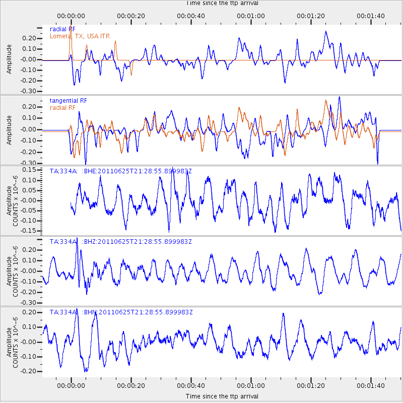
334A Lometa, TX, USA - Earthquake Result Viewer
*The percent match for this event was below the threshold and hence no stack was calculated.
| Earthquake location: |
South Of Fiji Islands |
| Earthquake latitude/longitude: |
-24.5/179.4 |
| Earthquake time(UTC): |
2011/06/25 (176) 21:16:55 GMT |
| Earthquake Depth: |
528 km |
| Earthquake Magnitude: |
5.5 MB, 5.6 MW, 5.6 MW |
| Earthquake Catalog/Contributor: |
WHDF/NEIC |
|
| Network: |
TA USArray Transportable Network (new EarthScope stations) |
| Station: |
334A Lometa, TX, USA |
| Lat/Lon: |
31.33 N/98.24 W |
| Elevation: |
389 m |
|
| Distance: |
96.3 deg |
| Az: |
58.582 deg |
| Baz: |
245.291 deg |
| Ray Param: |
$rayparam |
*The percent match for this event was below the threshold and hence was not used in the summary stack. |
|
| Radial Match: |
63.25885 % |
| Radial Bump: |
400 |
| Transverse Match: |
51.580284 % |
| Transverse Bump: |
400 |
| SOD ConfigId: |
395004 |
| Insert Time: |
2011-12-08 04:36:14.429 +0000 |
| GWidth: |
2.5 |
| Max Bumps: |
400 |
| Tol: |
0.001 |
|
Signal To Noise
| Channel | StoN | STA | LTA |
| TA:334A: :BHZ:20110625T21:28:55.899983Z | 1.9005811 | 1.196342E-7 | 6.294611E-8 |
| TA:334A: :BHN:20110625T21:28:55.899983Z | 1.9242541 | 1.2401262E-7 | 6.444711E-8 |
| TA:334A: :BHE:20110625T21:28:55.899983Z | 1.9306687 | 9.390879E-8 | 4.8640555E-8 |
| Arrivals |
| Ps | |
| PpPs | |
| PsPs/PpSs | |


