You are here: Home > Network List > TA - USArray Transportable Network (new EarthScope stations) Stations List
> Station J01D Myrtle Point, OR, USA > Earthquake Result Viewer
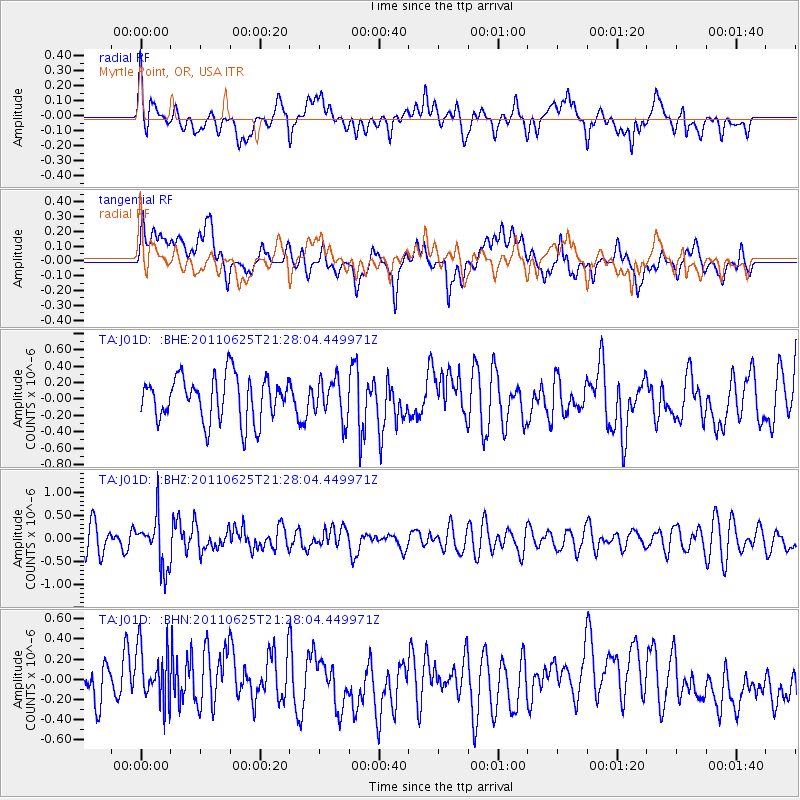
J01D Myrtle Point, OR, USA - Earthquake Result Viewer
*The percent match for this event was below the threshold and hence no stack was calculated.
| Earthquake location: |
South Of Fiji Islands |
| Earthquake latitude/longitude: |
-24.5/179.4 |
| Earthquake time(UTC): |
2011/06/25 (176) 21:16:55 GMT |
| Earthquake Depth: |
528 km |
| Earthquake Magnitude: |
5.5 MB, 5.6 MW, 5.6 MW |
| Earthquake Catalog/Contributor: |
WHDF/NEIC |
|
| Network: |
TA USArray Transportable Network (new EarthScope stations) |
| Station: |
J01D Myrtle Point, OR, USA |
| Lat/Lon: |
43.16 N/123.93 W |
| Elevation: |
131 m |
|
| Distance: |
85.1 deg |
| Az: |
37.863 deg |
| Baz: |
229.826 deg |
| Ray Param: |
$rayparam |
*The percent match for this event was below the threshold and hence was not used in the summary stack. |
|
| Radial Match: |
57.239952 % |
| Radial Bump: |
400 |
| Transverse Match: |
51.069588 % |
| Transverse Bump: |
400 |
| SOD ConfigId: |
395004 |
| Insert Time: |
2011-12-08 04:36:52.511 +0000 |
| GWidth: |
2.5 |
| Max Bumps: |
400 |
| Tol: |
0.001 |
|
Signal To Noise
| Channel | StoN | STA | LTA |
| TA:J01D: :BHZ:20110625T21:28:04.449971Z | 2.1930258 | 5.4445775E-7 | 2.4826784E-7 |
| TA:J01D: :BHN:20110625T21:28:04.449971Z | 1.4985049 | 2.981095E-7 | 1.9893798E-7 |
| TA:J01D: :BHE:20110625T21:28:04.449971Z | 0.8913162 | 2.408371E-7 | 2.7020388E-7 |
| Arrivals |
| Ps | |
| PpPs | |
| PsPs/PpSs | |


