You are here: Home > Network List > UW - Pacific Northwest Regional Seismic Network Stations List
> Station LEBA Lebam, WA, USA > Earthquake Result Viewer
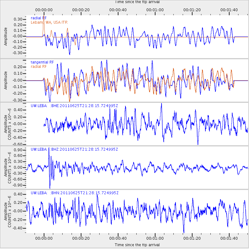
LEBA Lebam, WA, USA - Earthquake Result Viewer
*The percent match for this event was below the threshold and hence no stack was calculated.
| Earthquake location: |
South Of Fiji Islands |
| Earthquake latitude/longitude: |
-24.5/179.4 |
| Earthquake time(UTC): |
2011/06/25 (176) 21:16:55 GMT |
| Earthquake Depth: |
528 km |
| Earthquake Magnitude: |
5.5 MB, 5.6 MW, 5.6 MW |
| Earthquake Catalog/Contributor: |
WHDF/NEIC |
|
| Network: |
UW Pacific Northwest Regional Seismic Network |
| Station: |
LEBA Lebam, WA, USA |
| Lat/Lon: |
46.55 N/123.56 W |
| Elevation: |
73 m |
|
| Distance: |
87.5 deg |
| Az: |
35.439 deg |
| Baz: |
229.93 deg |
| Ray Param: |
$rayparam |
*The percent match for this event was below the threshold and hence was not used in the summary stack. |
|
| Radial Match: |
49.140102 % |
| Radial Bump: |
400 |
| Transverse Match: |
55.551895 % |
| Transverse Bump: |
400 |
| SOD ConfigId: |
395004 |
| Insert Time: |
2011-12-08 04:39:08.886 +0000 |
| GWidth: |
2.5 |
| Max Bumps: |
400 |
| Tol: |
0.001 |
|
Signal To Noise
| Channel | StoN | STA | LTA |
| UW:LEBA: :BHZ:20110625T21:28:15.724995Z | 3.6049807 | 3.8171206E-7 | 1.0588464E-7 |
| UW:LEBA: :BHN:20110625T21:28:15.724995Z | 0.7994949 | 1.2059651E-7 | 1.5084089E-7 |
| UW:LEBA: :BHE:20110625T21:28:15.724995Z | 1.482943 | 1.7545277E-7 | 1.1831389E-7 |
| Arrivals |
| Ps | |
| PpPs | |
| PsPs/PpSs | |


