You are here: Home > Network List > BK - Berkeley Digital Seismograph Network Stations List
> Station HUMO Hull Mountain, OR > Earthquake Result Viewer
HUMO Hull Mountain, OR - Earthquake Result Viewer
*The percent match for this event was below the threshold and hence no stack was calculated.
| Earthquake location: |
Mariana Islands |
| Earthquake latitude/longitude: |
18.9/146.3 |
| Earthquake time(UTC): |
2011/06/26 (177) 09:19:48 GMT |
| Earthquake Depth: |
99 km |
| Earthquake Magnitude: |
5.6 MB, 5.5 MW, 5.5 MW |
| Earthquake Catalog/Contributor: |
WHDF/NEIC |
|
| Network: |
BK Berkeley Digital Seismograph Network |
| Station: |
HUMO Hull Mountain, OR |
| Lat/Lon: |
42.61 N/122.96 W |
| Elevation: |
555 m |
|
| Distance: |
78.0 deg |
| Az: |
48.992 deg |
| Baz: |
284.551 deg |
| Ray Param: |
$rayparam |
*The percent match for this event was below the threshold and hence was not used in the summary stack. |
|
| Radial Match: |
63.679146 % |
| Radial Bump: |
400 |
| Transverse Match: |
64.71526 % |
| Transverse Bump: |
400 |
| SOD ConfigId: |
395004 |
| Insert Time: |
2011-12-08 04:45:02.418 +0000 |
| GWidth: |
2.5 |
| Max Bumps: |
400 |
| Tol: |
0.001 |
|
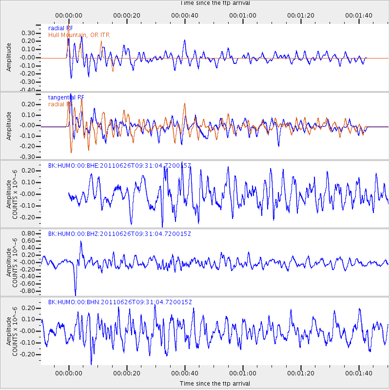
Signal To Noise
| Channel | StoN | STA | LTA |
| BK:HUMO:00:BHZ:20110626T09:31:04.720015Z | 3.2599378 | 3.237325E-7 | 9.930635E-8 |
| BK:HUMO:00:BHN:20110626T09:31:04.720015Z | 1.3336459 | 7.937105E-8 | 5.9514335E-8 |
| BK:HUMO:00:BHE:20110626T09:31:04.720015Z | 1.7176573 | 1.305873E-7 | 7.6026396E-8 |
| Arrivals |
| Ps | |
| PpPs | |
| PsPs/PpSs | |


