
ATD Arta Cave, Djibouti - Earthquake Result Viewer
| ||||||||||||||||||
| ||||||||||||||||||
| ||||||||||||||||||
|
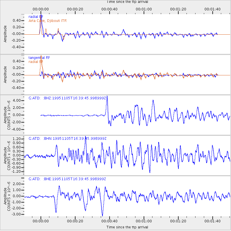
Signal To Noise
| Channel | StoN | STA | LTA |
| G:ATD: :BHN:19951105T16:39:45.998999Z | 0.7142841 | 7.232576E-8 | 1.012563E-7 |
| G:ATD: :BHE:19951105T16:39:45.998999Z | 1.0570874 | 7.594413E-8 | 7.1842805E-8 |
| G:ATD: :BHZ:19951105T16:39:45.998999Z | 1.5000185 | 1.01369665E-7 | 6.7578945E-8 |
| Arrivals | |
| Ps | 2.6 SECOND |
| PpPs | 10 SECOND |
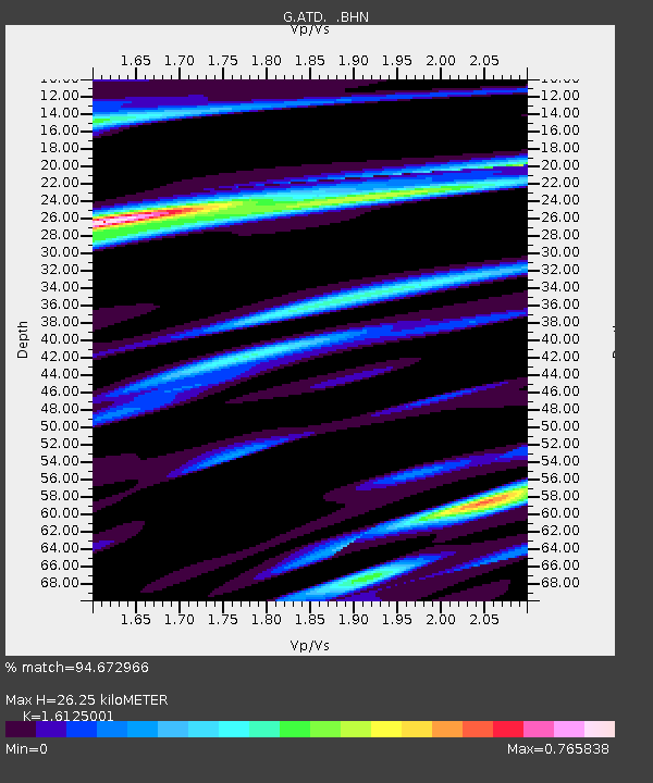
| PsPs/PpSs | 13 SECOND |

