You are here: Home > Network List > TA - USArray Transportable Network (new EarthScope stations) Stations List
> Station MDND Maddock, ND, USA > Earthquake Result Viewer
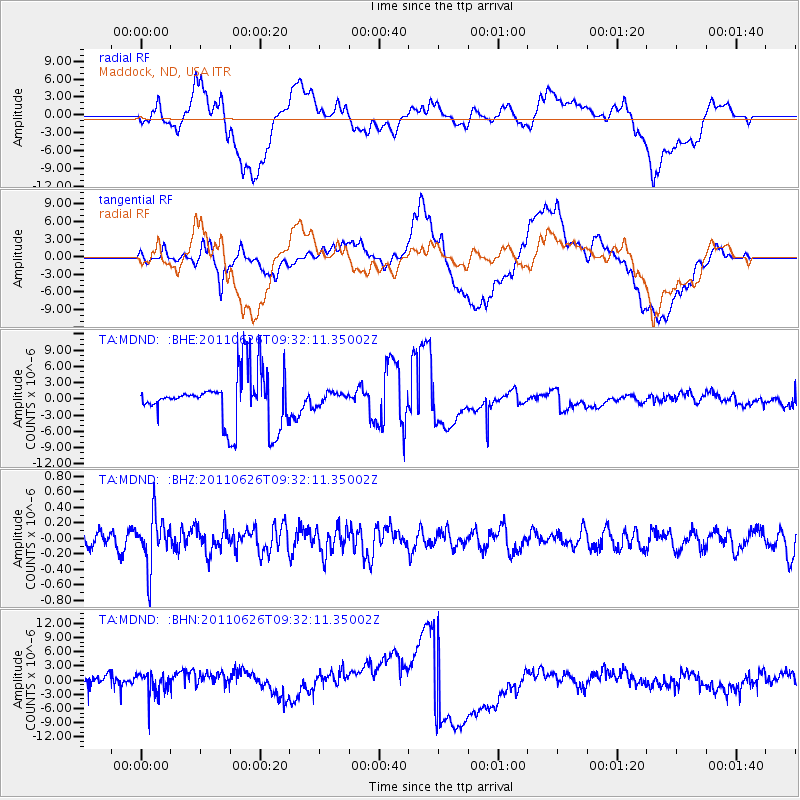
MDND Maddock, ND, USA - Earthquake Result Viewer
*The percent match for this event was below the threshold and hence no stack was calculated.
| Earthquake location: |
Mariana Islands |
| Earthquake latitude/longitude: |
18.9/146.3 |
| Earthquake time(UTC): |
2011/06/26 (177) 09:19:48 GMT |
| Earthquake Depth: |
99 km |
| Earthquake Magnitude: |
5.6 MB, 5.5 MW, 5.5 MW |
| Earthquake Catalog/Contributor: |
WHDF/NEIC |
|
| Network: |
TA USArray Transportable Network (new EarthScope stations) |
| Station: |
MDND Maddock, ND, USA |
| Lat/Lon: |
47.85 N/99.60 W |
| Elevation: |
479 m |
|
| Distance: |
91.3 deg |
| Az: |
37.947 deg |
| Baz: |
300.172 deg |
| Ray Param: |
$rayparam |
*The percent match for this event was below the threshold and hence was not used in the summary stack. |
|
| Radial Match: |
48.32487 % |
| Radial Bump: |
400 |
| Transverse Match: |
46.944935 % |
| Transverse Bump: |
400 |
| SOD ConfigId: |
395004 |
| Insert Time: |
2011-12-08 04:53:21.620 +0000 |
| GWidth: |
2.5 |
| Max Bumps: |
400 |
| Tol: |
0.001 |
|
Signal To Noise
| Channel | StoN | STA | LTA |
| TA:MDND: :BHZ:20110626T09:32:11.35002Z | 2.710133 | 3.257128E-7 | 1.2018332E-7 |
| TA:MDND: :BHN:20110626T09:32:11.35002Z | 0.79752374 | 2.2959719E-6 | 2.8788759E-6 |
| TA:MDND: :BHE:20110626T09:32:11.35002Z | 0.25101468 | 1.1865998E-6 | 4.7272124E-6 |
| Arrivals |
| Ps | |
| PpPs | |
| PsPs/PpSs | |


