You are here: Home > Network List > IW - Intermountain West Stations List
> Station MOOW Moose Ponds, Wyoming, USA > Earthquake Result Viewer
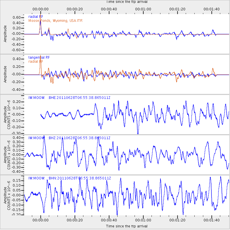
MOOW Moose Ponds, Wyoming, USA - Earthquake Result Viewer
*The percent match for this event was below the threshold and hence no stack was calculated.
| Earthquake location: |
Fox Islands, Aleutian Islands |
| Earthquake latitude/longitude: |
52.1/-171.7 |
| Earthquake time(UTC): |
2011/06/28 (179) 06:48:32 GMT |
| Earthquake Depth: |
30 km |
| Earthquake Magnitude: |
5.6 MB, 5.4 MS, 5.9 MW, 5.6 MW |
| Earthquake Catalog/Contributor: |
WHDF/NEIC |
|
| Network: |
IW Intermountain West |
| Station: |
MOOW Moose Ponds, Wyoming, USA |
| Lat/Lon: |
43.75 N/110.74 W |
| Elevation: |
2128 m |
|
| Distance: |
40.6 deg |
| Az: |
76.824 deg |
| Baz: |
304.002 deg |
| Ray Param: |
$rayparam |
*The percent match for this event was below the threshold and hence was not used in the summary stack. |
|
| Radial Match: |
72.01036 % |
| Radial Bump: |
400 |
| Transverse Match: |
67.08653 % |
| Transverse Bump: |
400 |
| SOD ConfigId: |
395004 |
| Insert Time: |
2011-12-08 05:36:01.336 +0000 |
| GWidth: |
2.5 |
| Max Bumps: |
400 |
| Tol: |
0.001 |
|
Signal To Noise
| Channel | StoN | STA | LTA |
| IW:MOOW: :BHZ:20110628T06:55:38.865011Z | 5.5866475 | 2.1349837E-7 | 3.821583E-8 |
| IW:MOOW: :BHN:20110628T06:55:38.865011Z | 3.307187 | 9.084376E-8 | 2.746859E-8 |
| IW:MOOW: :BHE:20110628T06:55:38.865011Z | 3.088762 | 9.898414E-8 | 3.204654E-8 |
| Arrivals |
| Ps | |
| PpPs | |
| PsPs/PpSs | |


