LUPA Lehigh University, PA - Earthquake Result Viewer
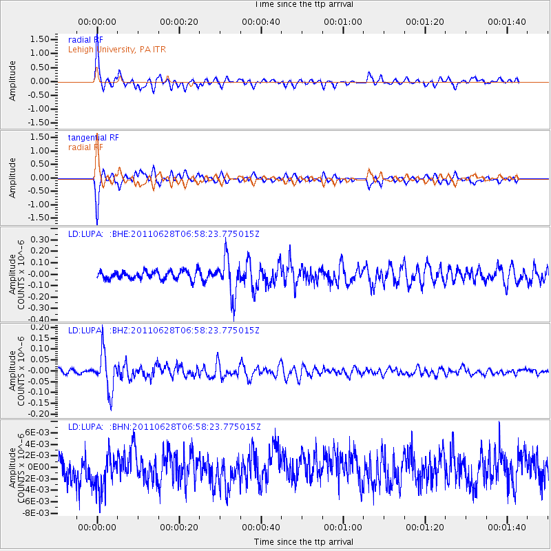
Earthquake location: Fox Islands, Aleutian Islands
Earthquake latitude/longitude: 52.1/-171.7
Earthquake time(UTC): 2011/06/28 (179) 06:48:32 GMT
Earthquake Depth: 30 km
Earthquake Magnitude: 5.6 MB, 5.4 MS, 5.9 MW, 5.6 MW
Earthquake Catalog/Contributor: WHDF/NEIC
Network: LD Lamont-Doherty Cooperative Seismographic Network
Station: LUPA Lehigh University, PA
Lat/Lon: 40.60 N/75.37 W
Elevation: 236 m
Distance: 62.7 deg
Az: 58.374 deg
Baz: 316.37 deg
Ray Param: 0.05999419
Estimated Moho Depth: 33.5 km
Estimated Crust Vp/Vs: 2.05
Assumed Crust Vp: 6.283 km/s
Estimated Crust Vs: 3.065 km/s
Estimated Crust Poisson's Ratio: 0.34
Radial Match: 88.58195 %
Radial Bump: 400
Transverse Match: 88.45999 %
Transverse Bump: 400
SOD ConfigId: 395004
Insert Time: 2011-12-08 05:38:47.410 +0000
GWidth: 2.5
Max Bumps: 400
Tol: 0.001

Signal To Noise

ChannelStoNSTALTA
LD:LUPA: :BHZ:20110628T06:58:23.775015Z11.5674478.833145E-87.636209E-9
LD:LUPA: :BHN:20110628T06:58:23.775015Z1.43077483.3959904E-92.3735325E-9
LD:LUPA: :BHE:20110628T06:58:23.775015Z4.6447551.6724974E-73.6008306E-8
Arrivals
Ps5.8 SECOND
PpPs16 SECOND
PsPs/PpSs21 SECOND