K30A Basset, NE, USA - Earthquake Result Viewer
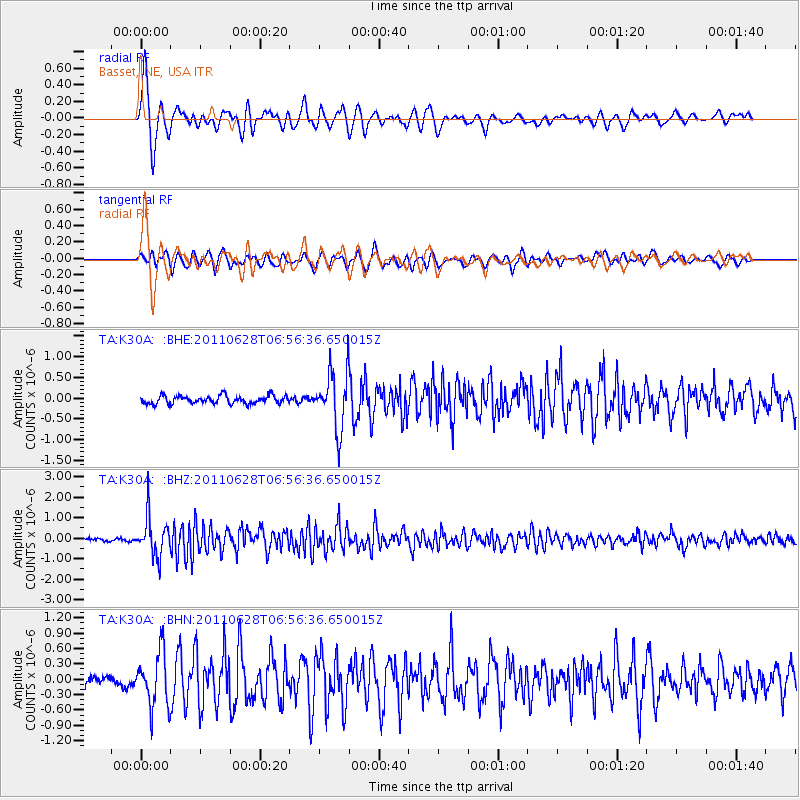
Earthquake location: Fox Islands, Aleutian Islands
Earthquake latitude/longitude: 52.1/-171.7
Earthquake time(UTC): 2011/06/28 (179) 06:48:32 GMT
Earthquake Depth: 30 km
Earthquake Magnitude: 5.6 MB, 5.4 MS, 5.9 MW, 5.6 MW
Earthquake Catalog/Contributor: WHDF/NEIC
Network: TA USArray Transportable Network (new EarthScope stations)
Station: K30A Basset, NE, USA
Lat/Lon: 42.67 N/99.61 W
Elevation: 712 m
Distance: 47.8 deg
Az: 71.248 deg
Baz: 307.603 deg
Ray Param: 0.069692396
Estimated Moho Depth: 10.0 km
Estimated Crust Vp/Vs: 1.60
Assumed Crust Vp: 6.53 km/s
Estimated Crust Vs: 4.082 km/s
Estimated Crust Poisson's Ratio: 0.18
Radial Match: 92.155075 %
Radial Bump: 400
Transverse Match: 79.020325 %
Transverse Bump: 400
SOD ConfigId: 395004
Insert Time: 2011-12-08 05:47:37.693 +0000
GWidth: 2.5
Max Bumps: 400
Tol: 0.001

Signal To Noise

ChannelStoNSTALTA
TA:K30A: :BHZ:20110628T06:56:36.650015Z12.6226669.286345E-77.3568806E-8
TA:K30A: :BHN:20110628T06:56:36.650015Z5.2880175.2341926E-79.898215E-8
TA:K30A: :BHE:20110628T06:56:36.650015Z7.1775156.925745E-79.649224E-8
Arrivals
Ps1.0 SECOND
PpPs3.7 SECOND
PsPs/PpSs4.7 SECOND