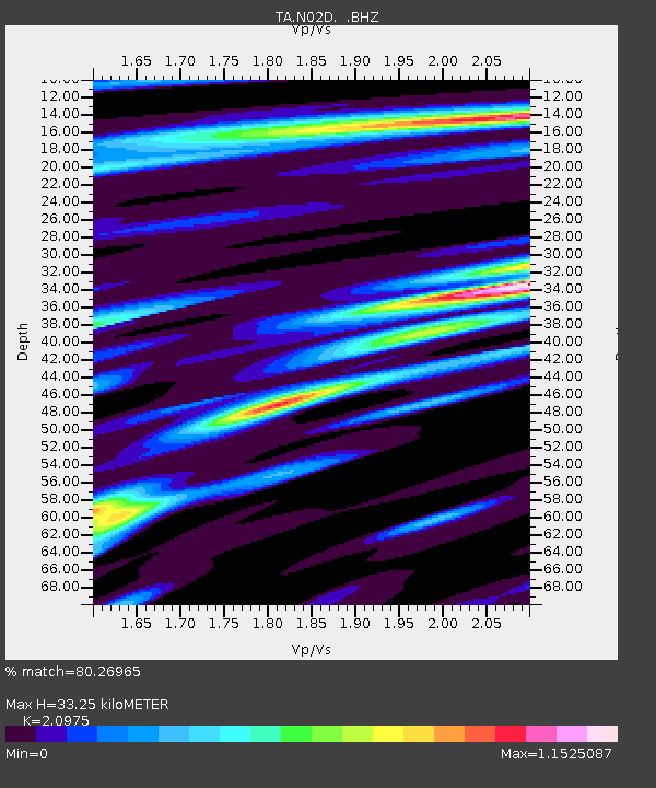
N02D Trinity Center, CA, USA - Earthquake Result Viewer
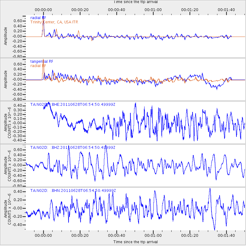
Earthquake location: Fox Islands, Aleutian Islands
Earthquake latitude/longitude: 52.1/-171.7
Earthquake time(UTC): 2011/06/28 (179) 06:48:32 GMT
Earthquake Depth: 30 km
Earthquake Magnitude: 5.6 MB, 5.4 MS, 5.9 MW, 5.6 MW
Earthquake Catalog/Contributor: WHDF/NEIC
Network: TA USArray Transportable Network (new EarthScope stations)
Station: N02D Trinity Center, CA, USA
Lat/Lon: 40.97 N/122.71 W
Elevation: 937 m
Distance: 34.9 deg
Az: 88.786 deg
Baz: 305.44 deg
Ray Param: 0.07747328
Estimated Moho Depth: 33.25 km
Estimated Crust Vp/Vs: 2.10
Assumed Crust Vp: 6.566 km/s
Estimated Crust Vs: 3.13 km/s
Estimated Crust Poisson's Ratio: 0.35
Radial Match: 80.26965 %
Radial Bump: 400
Transverse Match: 37.701756 %
Transverse Bump: 400
SOD ConfigId: 395004
Insert Time: 2011-12-08 05:49:47.311 +0000
GWidth: 2.5
Max Bumps: 400
Tol: 0.001

Signal To Noise

ChannelStoNSTALTA
TA:N02D: :BHZ:20110628T06:54:50.49999Z2.1995421.9425492E-78.831607E-8
TA:N02D: :BHN:20110628T06:54:50.49999Z1.01334893.2292206E-73.1866819E-7
TA:N02D: :BHE:20110628T06:54:50.49999Z1.02533471.887109E-71.8404809E-7
Arrivals
Ps5.9 SECOND
PpPs15 SECOND
PsPs/PpSs21 SECOND