434A Burnet, TX, USA - Earthquake Result Viewer
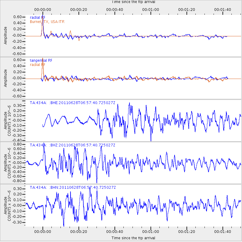
Earthquake location: Fox Islands, Aleutian Islands
Earthquake latitude/longitude: 52.1/-171.7
Earthquake time(UTC): 2011/06/28 (179) 06:48:32 GMT
Earthquake Depth: 30 km
Earthquake Magnitude: 5.6 MB, 5.4 MS, 5.9 MW, 5.6 MW
Earthquake Catalog/Contributor: WHDF/NEIC
Network: TA USArray Transportable Network (new EarthScope stations)
Station: 434A Burnet, TX, USA
Lat/Lon: 30.81 N/98.27 W
Elevation: 462 m
Distance: 56.5 deg
Az: 81.621 deg
Baz: 314.803 deg
Ray Param: 0.06407549
Estimated Moho Depth: 29.5 km
Estimated Crust Vp/Vs: 1.89
Assumed Crust Vp: 6.498 km/s
Estimated Crust Vs: 3.429 km/s
Estimated Crust Poisson's Ratio: 0.31
Radial Match: 83.489746 %
Radial Bump: 400
Transverse Match: 65.82941 %
Transverse Bump: 400
SOD ConfigId: 395004
Insert Time: 2011-12-08 05:50:26.947 +0000
GWidth: 2.5
Max Bumps: 400
Tol: 0.001

Signal To Noise

ChannelStoNSTALTA
TA:434A: :BHZ:20110628T06:57:40.725027Z5.587773.443796E-76.1630956E-8
TA:434A: :BHN:20110628T06:57:40.725027Z3.2992561.04071496E-73.154393E-8
TA:434A: :BHE:20110628T06:57:40.725027Z2.15981771.3044871E-76.0398015E-8
Arrivals
Ps4.3 SECOND
PpPs13 SECOND
PsPs/PpSs17 SECOND