
334A Lometa, TX, USA - Earthquake Result Viewer
| ||||||||||||||||||
| ||||||||||||||||||
| ||||||||||||||||||
|
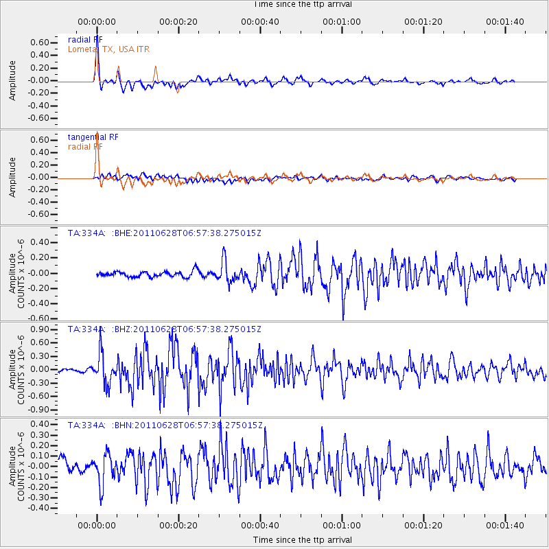
Signal To Noise
| Channel | StoN | STA | LTA |
| TA:334A: :BHZ:20110628T06:57:38.275015Z | 6.3596983 | 3.4604537E-7 | 5.441223E-8 |
| TA:334A: :BHN:20110628T06:57:38.275015Z | 2.6622522 | 1.4896011E-7 | 5.5952672E-8 |
| TA:334A: :BHE:20110628T06:57:38.275015Z | 3.874273 | 1.4154178E-7 | 3.6533763E-8 |
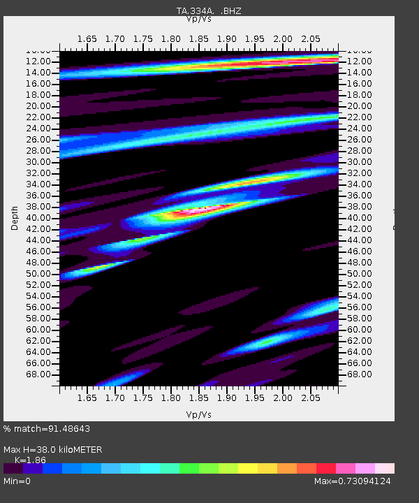
| Arrivals | |
| Ps | 5.3 SECOND |
| PpPs | 16 SECOND |
| PsPs/PpSs | 21 SECOND |

