234A Clairette, TX, USA - Earthquake Result Viewer
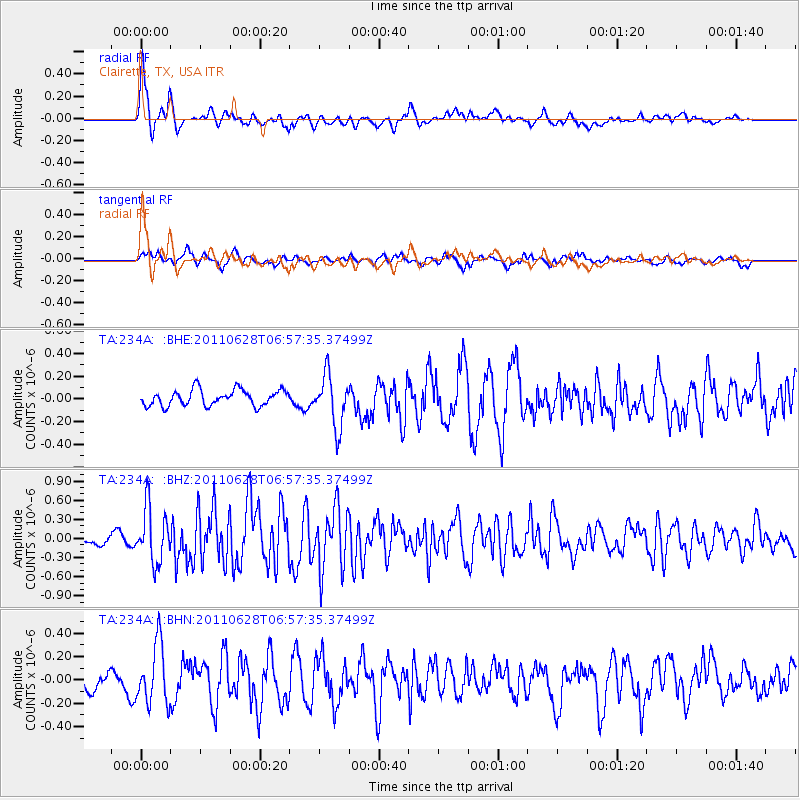
Earthquake location: Fox Islands, Aleutian Islands
Earthquake latitude/longitude: 52.1/-171.7
Earthquake time(UTC): 2011/06/28 (179) 06:48:32 GMT
Earthquake Depth: 30 km
Earthquake Magnitude: 5.6 MB, 5.4 MS, 5.9 MW, 5.6 MW
Earthquake Catalog/Contributor: WHDF/NEIC
Network: TA USArray Transportable Network (new EarthScope stations)
Station: 234A Clairette, TX, USA
Lat/Lon: 32.00 N/98.14 W
Elevation: 358 m
Distance: 55.7 deg
Az: 80.506 deg
Baz: 314.249 deg
Ray Param: 0.06456423
Estimated Moho Depth: 13.0 km
Estimated Crust Vp/Vs: 1.60
Assumed Crust Vp: 6.426 km/s
Estimated Crust Vs: 4.016 km/s
Estimated Crust Poisson's Ratio: 0.18
Radial Match: 85.228714 %
Radial Bump: 400
Transverse Match: 72.80852 %
Transverse Bump: 400
SOD ConfigId: 395004
Insert Time: 2011-12-08 05:51:06.866 +0000
GWidth: 2.5
Max Bumps: 400
Tol: 0.001

Signal To Noise

ChannelStoNSTALTA
TA:234A: :BHZ:20110628T06:57:35.37499Z6.65116644.263603E-76.4103084E-8
TA:234A: :BHN:20110628T06:57:35.37499Z3.739712.5597257E-76.844717E-8
TA:234A: :BHE:20110628T06:57:35.37499Z3.28157572.2878939E-76.971937E-8
Arrivals
Ps1.3 SECOND
PpPs5.0 SECOND
PsPs/PpSs6.3 SECOND