336A Riesel, TX, USA - Earthquake Result Viewer
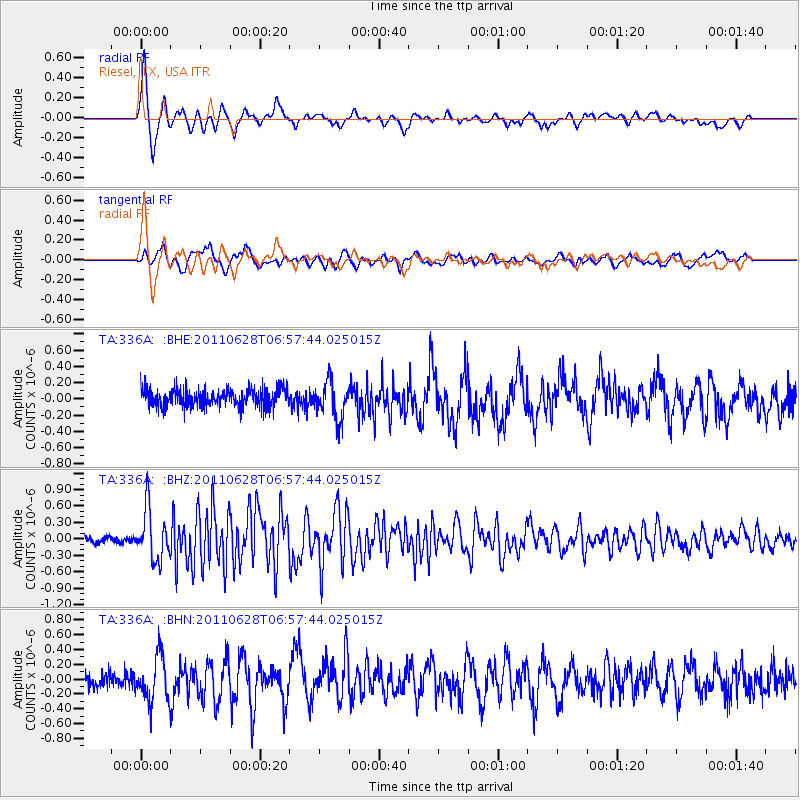
Earthquake location: Fox Islands, Aleutian Islands
Earthquake latitude/longitude: 52.1/-171.7
Earthquake time(UTC): 2011/06/28 (179) 06:48:32 GMT
Earthquake Depth: 30 km
Earthquake Magnitude: 5.6 MB, 5.4 MS, 5.9 MW, 5.6 MW
Earthquake Catalog/Contributor: WHDF/NEIC
Network: TA USArray Transportable Network (new EarthScope stations)
Station: 336A Riesel, TX, USA
Lat/Lon: 31.39 N/96.84 W
Elevation: 140 m
Distance: 56.9 deg
Az: 80.106 deg
Baz: 314.703 deg
Ray Param: 0.06376972
Estimated Moho Depth: 26.75 km
Estimated Crust Vp/Vs: 1.91
Assumed Crust Vp: 6.347 km/s
Estimated Crust Vs: 3.319 km/s
Estimated Crust Poisson's Ratio: 0.31
Radial Match: 86.37488 %
Radial Bump: 400
Transverse Match: 73.21061 %
Transverse Bump: 400
SOD ConfigId: 395004
Insert Time: 2011-12-08 05:52:16.314 +0000
GWidth: 2.5
Max Bumps: 400
Tol: 0.001

Signal To Noise

ChannelStoNSTALTA
TA:336A: :BHZ:20110628T06:57:44.025015Z6.6980554.5394967E-76.777336E-8
TA:336A: :BHN:20110628T06:57:44.025015Z2.91034533.021809E-71.03829905E-7
TA:336A: :BHE:20110628T06:57:44.025015Z2.07908772.2948981E-71.1038006E-7
Arrivals
Ps4.0 SECOND
PpPs12 SECOND
PsPs/PpSs16 SECOND