W36A Wetumka, OK, USA - Earthquake Result Viewer
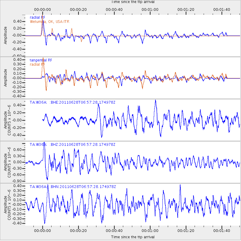
Earthquake location: Fox Islands, Aleutian Islands
Earthquake latitude/longitude: 52.1/-171.7
Earthquake time(UTC): 2011/06/28 (179) 06:48:32 GMT
Earthquake Depth: 30 km
Earthquake Magnitude: 5.6 MB, 5.4 MS, 5.9 MW, 5.6 MW
Earthquake Catalog/Contributor: WHDF/NEIC
Network: TA USArray Transportable Network (new EarthScope stations)
Station: W36A Wetumka, OK, USA
Lat/Lon: 35.14 N/96.23 W
Elevation: 251 m
Distance: 54.7 deg
Az: 76.409 deg
Baz: 312.963 deg
Ray Param: 0.06522535
Estimated Moho Depth: 29.5 km
Estimated Crust Vp/Vs: 2.00
Assumed Crust Vp: 6.426 km/s
Estimated Crust Vs: 3.209 km/s
Estimated Crust Poisson's Ratio: 0.33
Radial Match: 80.996826 %
Radial Bump: 382
Transverse Match: 69.61542 %
Transverse Bump: 400
SOD ConfigId: 395004
Insert Time: 2011-12-08 05:53:45.743 +0000
GWidth: 2.5
Max Bumps: 400
Tol: 0.001

Signal To Noise

ChannelStoNSTALTA
TA:W36A: :BHZ:20110628T06:57:28.174978Z8.4485894.900813E-75.8007473E-8
TA:W36A: :BHN:20110628T06:57:28.174978Z3.87397842.1099859E-75.4465612E-8
TA:W36A: :BHE:20110628T06:57:28.174978Z3.4814742.4195E-76.949644E-8
Arrivals
Ps4.8 SECOND
PpPs13 SECOND
PsPs/PpSs18 SECOND