
W35A Tecumseh, OK, USA - Earthquake Result Viewer
| ||||||||||||||||||
| ||||||||||||||||||
| ||||||||||||||||||
|
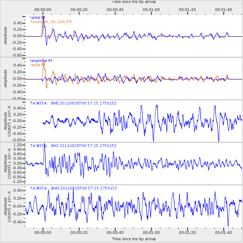
Signal To Noise
| Channel | StoN | STA | LTA |
| TA:W35A: :BHZ:20110628T06:57:25.275015Z | 7.6963973 | 4.935346E-7 | 6.412541E-8 |
| TA:W35A: :BHN:20110628T06:57:25.275015Z | 2.1339674 | 1.7048283E-7 | 7.9890086E-8 |
| TA:W35A: :BHE:20110628T06:57:25.275015Z | 2.3015428 | 1.8232541E-7 | 7.921878E-8 |
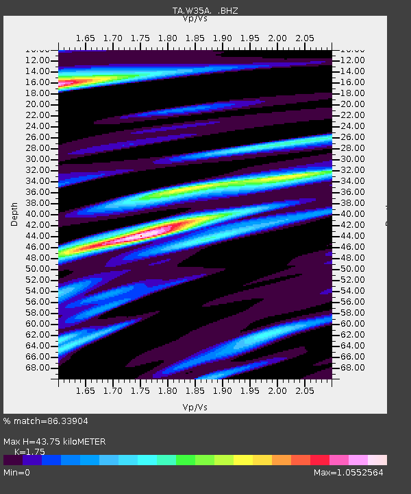
| Arrivals | |
| Ps | 5.4 SECOND |
| PpPs | 18 SECOND |
| PsPs/PpSs | 23 SECOND |

