Y37A Hugo, OK, USA - Earthquake Result Viewer
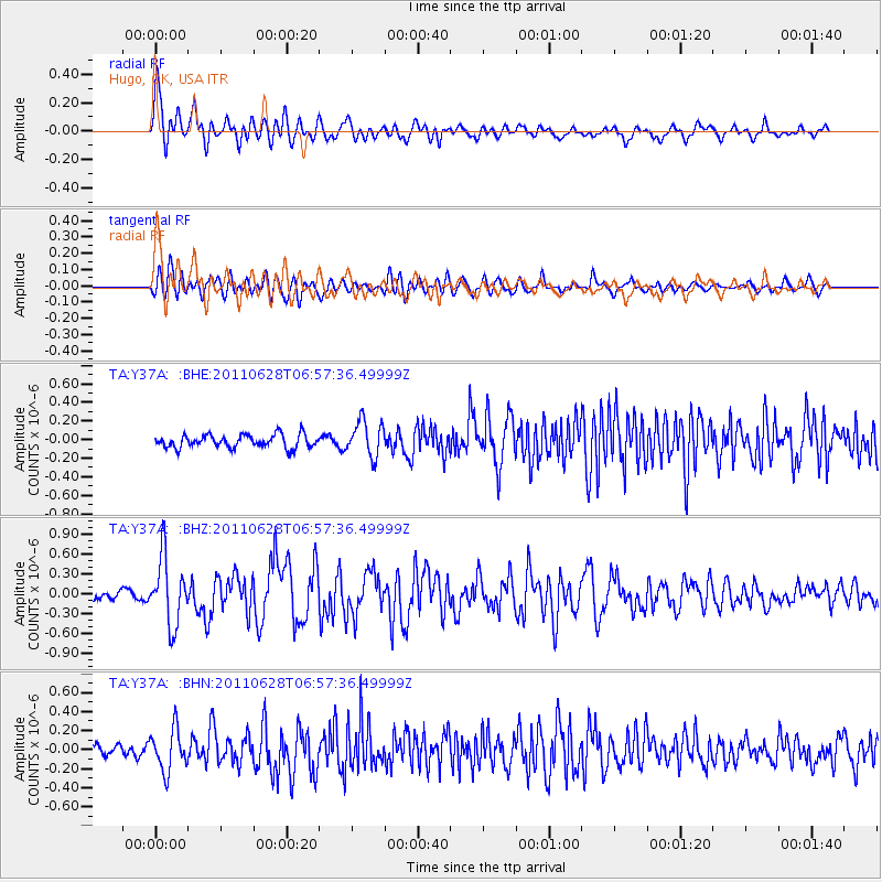
Earthquake location: Fox Islands, Aleutian Islands
Earthquake latitude/longitude: 52.1/-171.7
Earthquake time(UTC): 2011/06/28 (179) 06:48:32 GMT
Earthquake Depth: 30 km
Earthquake Magnitude: 5.6 MB, 5.4 MS, 5.9 MW, 5.6 MW
Earthquake Catalog/Contributor: WHDF/NEIC
Network: TA USArray Transportable Network (new EarthScope stations)
Station: Y37A Hugo, OK, USA
Lat/Lon: 33.98 N/95.62 W
Elevation: 165 m
Distance: 55.9 deg
Az: 77.017 deg
Baz: 313.651 deg
Ray Param: 0.06446296
Estimated Moho Depth: 12.0 km
Estimated Crust Vp/Vs: 2.10
Assumed Crust Vp: 6.245 km/s
Estimated Crust Vs: 2.977 km/s
Estimated Crust Poisson's Ratio: 0.35
Radial Match: 80.031044 %
Radial Bump: 400
Transverse Match: 75.35098 %
Transverse Bump: 400
SOD ConfigId: 395004
Insert Time: 2011-12-08 05:54:49.303 +0000
GWidth: 2.5
Max Bumps: 400
Tol: 0.001

Signal To Noise

ChannelStoNSTALTA
TA:Y37A: :BHZ:20110628T06:57:36.49999Z5.71216735.09537E-78.920205E-8
TA:Y37A: :BHN:20110628T06:57:36.49999Z4.14027742.1794406E-75.2639965E-8
TA:Y37A: :BHE:20110628T06:57:36.49999Z2.7153581.904481E-77.013738E-8
Arrivals
Ps2.2 SECOND
PpPs5.7 SECOND
PsPs/PpSs7.9 SECOND