You are here: Home > Network List > TA - USArray Transportable Network (new EarthScope stations) Stations List
> Station I31A Royce, Wessington Springs, SD, USA > Earthquake Result Viewer
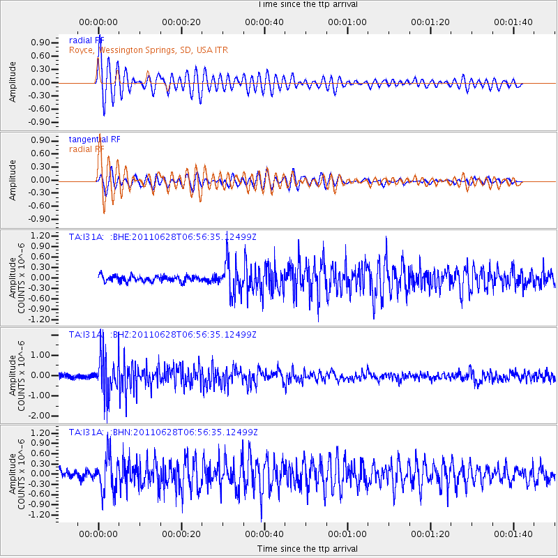
I31A Royce, Wessington Springs, SD, USA - Earthquake Result Viewer

| Earthquake location: |
Fox Islands, Aleutian Islands |
| Earthquake latitude/longitude: |
52.1/-171.7 |
| Earthquake time(UTC): |
2011/06/28 (179) 06:48:32 GMT |
| Earthquake Depth: |
30 km |
| Earthquake Magnitude: |
5.6 MB, 5.4 MS, 5.9 MW, 5.6 MW |
| Earthquake Catalog/Contributor: |
WHDF/NEIC |
|
| Network: |
TA USArray Transportable Network (new EarthScope stations) |
| Station: |
I31A Royce, Wessington Springs, SD, USA |
| Lat/Lon: |
44.03 N/98.54 W |
| Elevation: |
469 m |
|
| Distance: |
47.6 deg |
| Az: |
69.147 deg |
| Baz: |
306.927 deg |
| Ray Param: |
0.06981337 |
| Estimated Moho Depth: |
48.0 km |
| Estimated Crust Vp/Vs: |
1.60 |
| Assumed Crust Vp: |
6.53 km/s |
| Estimated Crust Vs: |
4.082 km/s |
| Estimated Crust Poisson's Ratio: |
0.18 |
|
| Radial Match: |
88.21519 % |
| Radial Bump: |
400 |
| Transverse Match: |
82.61561 % |
| Transverse Bump: |
400 |
| SOD ConfigId: |
395004 |
| Insert Time: |
2011-12-08 05:58:20.707 +0000 |
| GWidth: |
2.5 |
| Max Bumps: |
400 |
| Tol: |
0.001 |
|
Signal To Noise
| Channel | StoN | STA | LTA |
| TA:I31A: :BHZ:20110628T06:56:35.12499Z | 10.728851 | 1.004732E-6 | 9.364767E-8 |
| TA:I31A: :BHN:20110628T06:56:35.12499Z | 5.3261085 | 5.345239E-7 | 1.0035918E-7 |
| TA:I31A: :BHE:20110628T06:56:35.12499Z | 5.7230616 | 4.6248837E-7 | 8.0811354E-8 |
| Arrivals |
| Ps | 4.7 SECOND |
| PpPs | 18 SECOND |
| PsPs/PpSs | 23 SECOND |


