J35A Milford, IA, USA - Earthquake Result Viewer
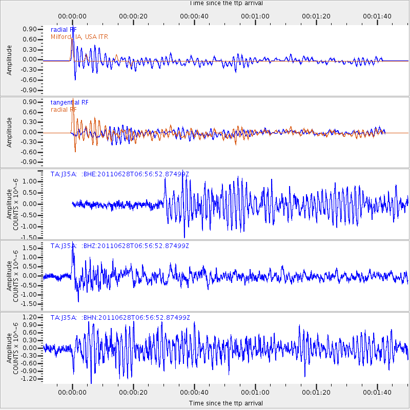
Earthquake location: Fox Islands, Aleutian Islands
Earthquake latitude/longitude: 52.1/-171.7
Earthquake time(UTC): 2011/06/28 (179) 06:48:32 GMT
Earthquake Depth: 30 km
Earthquake Magnitude: 5.6 MB, 5.4 MS, 5.9 MW, 5.6 MW
Earthquake Catalog/Contributor: WHDF/NEIC
Network: TA USArray Transportable Network (new EarthScope stations)
Station: J35A Milford, IA, USA
Lat/Lon: 43.37 N/95.21 W
Elevation: 457 m
Distance: 49.9 deg
Az: 67.886 deg
Baz: 308.387 deg
Ray Param: 0.06832471
Estimated Moho Depth: 21.25 km
Estimated Crust Vp/Vs: 1.86
Assumed Crust Vp: 6.53 km/s
Estimated Crust Vs: 3.506 km/s
Estimated Crust Poisson's Ratio: 0.30
Radial Match: 84.46466 %
Radial Bump: 400
Transverse Match: 79.63918 %
Transverse Bump: 400
SOD ConfigId: 395004
Insert Time: 2011-12-08 05:58:58.907 +0000
GWidth: 2.5
Max Bumps: 400
Tol: 0.001

Signal To Noise

ChannelStoNSTALTA
TA:J35A: :BHZ:20110628T06:56:52.87499Z8.35522656.517218E-77.800169E-8
TA:J35A: :BHN:20110628T06:56:52.87499Z3.2285243.6817366E-71.1403776E-7
TA:J35A: :BHE:20110628T06:56:52.87499Z5.30374964.5490384E-78.577023E-8
Arrivals
Ps3.0 SECOND
PpPs8.8 SECOND
PsPs/PpSs12 SECOND