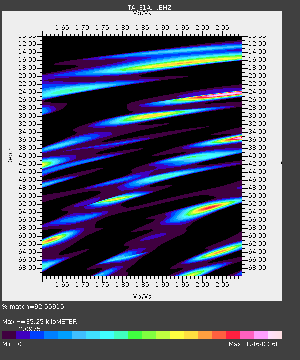
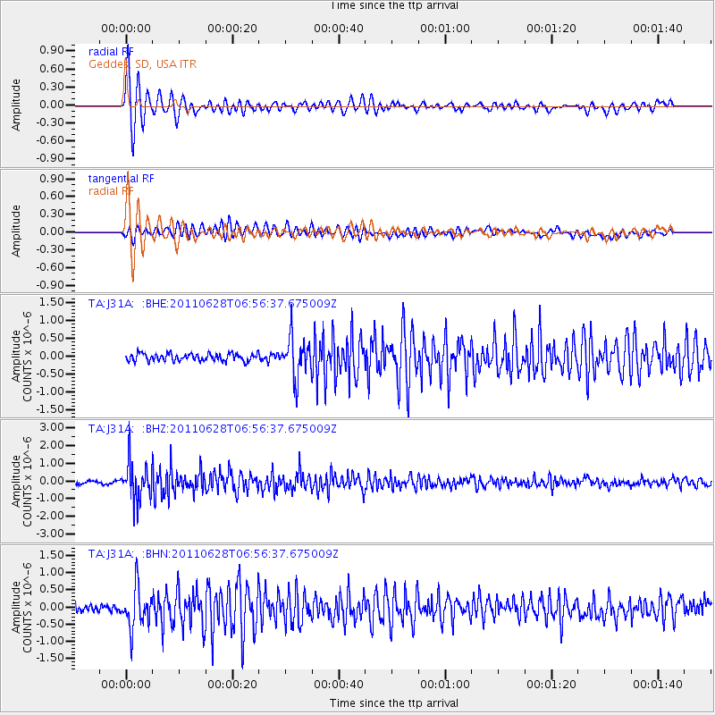
J31A Geddes, SD, USA - Earthquake Result Viewer

Earthquake location: Fox Islands, Aleutian Islands
Earthquake latitude/longitude: 52.1/-171.7
Earthquake time(UTC): 2011/06/28 (179) 06:48:32 GMT
Earthquake Depth: 30 km
Earthquake Magnitude: 5.6 MB, 5.4 MS, 5.9 MW, 5.6 MW
Earthquake Catalog/Contributor: WHDF/NEIC
Network: TA USArray Transportable Network (new EarthScope stations)
Station: J31A Geddes, SD, USA
Lat/Lon: 43.29 N/98.74 W
Elevation: 491 m
Distance: 48.0 deg
Az: 70.062 deg
Baz: 307.401 deg
Ray Param: 0.06960979
Estimated Moho Depth: 35.25 km
Estimated Crust Vp/Vs: 2.10
Assumed Crust Vp: 6.53 km/s
Estimated Crust Vs: 3.113 km/s
Estimated Crust Poisson's Ratio: 0.35
Radial Match: 92.55915 %
Radial Bump: 400
Transverse Match: 69.70831 %
Transverse Bump: 400
SOD ConfigId: 395004
Insert Time: 2011-12-08 05:59:24.438 +0000
GWidth: 2.5
Max Bumps: 400
Tol: 0.001

Signal To Noise

ChannelStoNSTALTA
TA:J31A: :BHZ:20110628T06:56:37.675009Z13.4245741.0494133E-67.817107E-8
TA:J31A: :BHN:20110628T06:56:37.675009Z4.32277255.946294E-71.3755742E-7
TA:J31A: :BHE:20110628T06:56:37.675009Z5.4650195.5920304E-71.0232408E-7
Arrivals
Ps6.2 SECOND
PpPs16 SECOND
PsPs/PpSs22 SECOND