E31A Nome, ND, USA - Earthquake Result Viewer
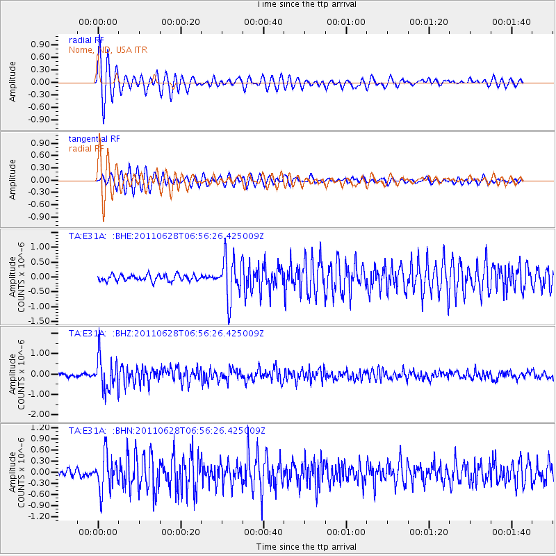
Earthquake location: Fox Islands, Aleutian Islands
Earthquake latitude/longitude: 52.1/-171.7
Earthquake time(UTC): 2011/06/28 (179) 06:48:32 GMT
Earthquake Depth: 30 km
Earthquake Magnitude: 5.6 MB, 5.4 MS, 5.9 MW, 5.6 MW
Earthquake Catalog/Contributor: WHDF/NEIC
Network: TA USArray Transportable Network (new EarthScope stations)
Station: E31A Nome, ND, USA
Lat/Lon: 46.56 N/97.89 W
Elevation: 427 m
Distance: 46.5 deg
Az: 65.988 deg
Baz: 305.234 deg
Ray Param: 0.07054636
Estimated Moho Depth: 23.5 km
Estimated Crust Vp/Vs: 1.67
Assumed Crust Vp: 6.498 km/s
Estimated Crust Vs: 3.897 km/s
Estimated Crust Poisson's Ratio: 0.22
Radial Match: 92.37949 %
Radial Bump: 379
Transverse Match: 87.72445 %
Transverse Bump: 388
SOD ConfigId: 395004
Insert Time: 2011-12-08 06:00:03.932 +0000
GWidth: 2.5
Max Bumps: 400
Tol: 0.001

Signal To Noise

ChannelStoNSTALTA
TA:E31A: :BHZ:20110628T06:56:26.425009Z11.1088418.1416124E-77.3289485E-8
TA:E31A: :BHN:20110628T06:56:26.425009Z4.571284.8960476E-71.0710452E-7
TA:E31A: :BHE:20110628T06:56:26.425009Z7.0146487.181527E-71.0237901E-7
Arrivals
Ps2.6 SECOND
PpPs9.0 SECOND
PsPs/PpSs12 SECOND