D34A Park Rapids, MN, USA - Earthquake Result Viewer
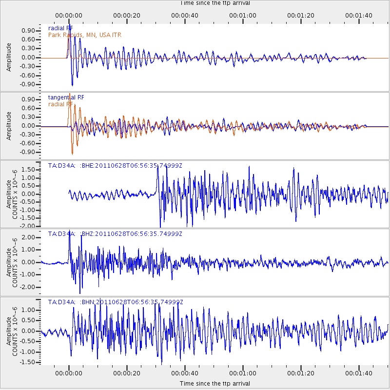
Earthquake location: Fox Islands, Aleutian Islands
Earthquake latitude/longitude: 52.1/-171.7
Earthquake time(UTC): 2011/06/28 (179) 06:48:32 GMT
Earthquake Depth: 30 km
Earthquake Magnitude: 5.6 MB, 5.4 MS, 5.9 MW, 5.6 MW
Earthquake Catalog/Contributor: WHDF/NEIC
Network: TA USArray Transportable Network (new EarthScope stations)
Station: D34A Park Rapids, MN, USA
Lat/Lon: 47.09 N/95.20 W
Elevation: 476 m
Distance: 47.7 deg
Az: 63.937 deg
Baz: 305.795 deg
Ray Param: 0.069764346
Estimated Moho Depth: 37.5 km
Estimated Crust Vp/Vs: 1.62
Assumed Crust Vp: 6.419 km/s
Estimated Crust Vs: 3.969 km/s
Estimated Crust Poisson's Ratio: 0.19
Radial Match: 90.011284 %
Radial Bump: 400
Transverse Match: 83.972725 %
Transverse Bump: 400
SOD ConfigId: 395004
Insert Time: 2011-12-08 06:04:12.929 +0000
GWidth: 2.5
Max Bumps: 400
Tol: 0.001

Signal To Noise

ChannelStoNSTALTA
TA:D34A: :BHZ:20110628T06:56:35.74999Z14.6786231.0837135E-67.382937E-8
TA:D34A: :BHN:20110628T06:56:35.74999Z5.0674675.166015E-71.0194472E-7
TA:D34A: :BHE:20110628T06:56:35.74999Z5.62437968.6446533E-71.5369967E-7
Arrivals
Ps3.9 SECOND
PpPs14 SECOND
PsPs/PpSs18 SECOND