
C33A Trail, MN, USA - Earthquake Result Viewer
| ||||||||||||||||||
| ||||||||||||||||||
| ||||||||||||||||||
|
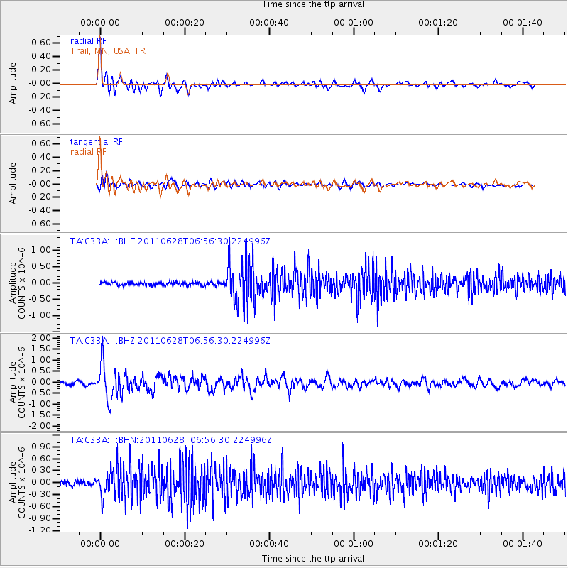
Signal To Noise
| Channel | StoN | STA | LTA |
| TA:C33A: :BHZ:20110628T06:56:30.224996Z | 15.196909 | 8.4466313E-7 | 5.5581246E-8 |
| TA:C33A: :BHN:20110628T06:56:30.224996Z | 6.709992 | 3.479667E-7 | 5.185799E-8 |
| TA:C33A: :BHE:20110628T06:56:30.224996Z | 14.85552 | 6.3798075E-7 | 4.29457E-8 |
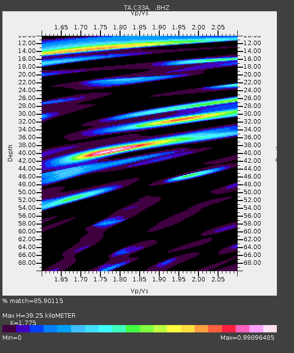
| Arrivals | |
| Ps | 5.0 SECOND |
| PpPs | 16 SECOND |
| PsPs/PpSs | 21 SECOND |

