D36A Goodland, MN, USA - Earthquake Result Viewer
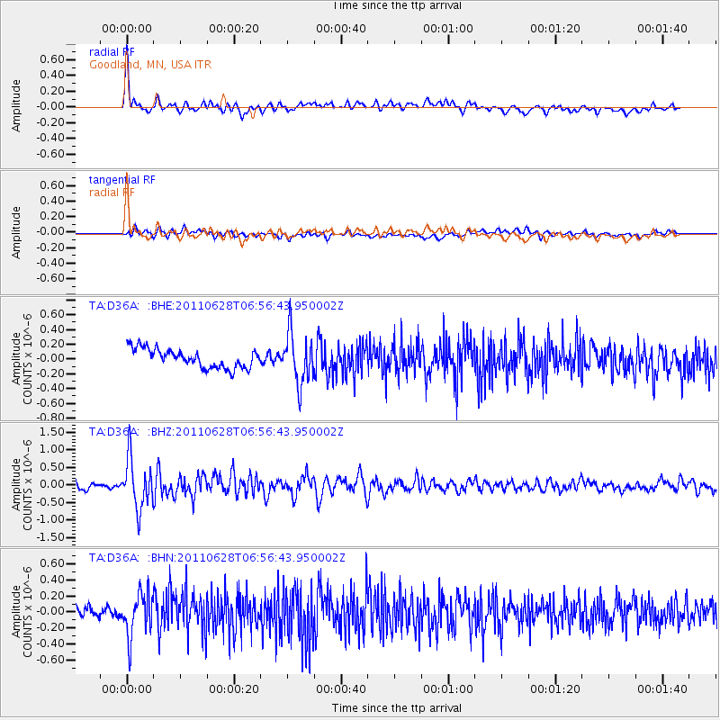
Earthquake location: Fox Islands, Aleutian Islands
Earthquake latitude/longitude: 52.1/-171.7
Earthquake time(UTC): 2011/06/28 (179) 06:48:32 GMT
Earthquake Depth: 30 km
Earthquake Magnitude: 5.6 MB, 5.4 MS, 5.9 MW, 5.6 MW
Earthquake Catalog/Contributor: WHDF/NEIC
Network: TA USArray Transportable Network (new EarthScope stations)
Station: D36A Goodland, MN, USA
Lat/Lon: 47.18 N/93.16 W
Elevation: 434 m
Distance: 48.8 deg
Az: 62.742 deg
Baz: 306.483 deg
Ray Param: 0.069080904
Estimated Moho Depth: 36.25 km
Estimated Crust Vp/Vs: 2.01
Assumed Crust Vp: 6.571 km/s
Estimated Crust Vs: 3.273 km/s
Estimated Crust Poisson's Ratio: 0.33
Radial Match: 84.23826 %
Radial Bump: 400
Transverse Match: 51.546986 %
Transverse Bump: 400
SOD ConfigId: 395004
Insert Time: 2011-12-08 06:04:50.648 +0000
GWidth: 2.5
Max Bumps: 400
Tol: 0.001

Signal To Noise

ChannelStoNSTALTA
TA:D36A: :BHZ:20110628T06:56:43.950002Z8.2525157.134168E-78.644841E-8
TA:D36A: :BHN:20110628T06:56:43.950002Z3.85842082.71551E-77.037879E-8
TA:D36A: :BHE:20110628T06:56:43.950002Z2.68622333.4358627E-71.2790682E-7
Arrivals
Ps5.9 SECOND
PpPs16 SECOND
PsPs/PpSs22 SECOND