D37A Cotton, MN, USA - Earthquake Result Viewer
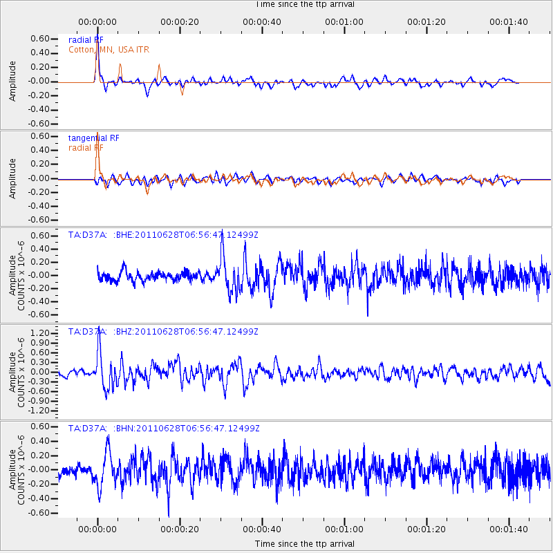
Earthquake location: Fox Islands, Aleutian Islands
Earthquake latitude/longitude: 52.1/-171.7
Earthquake time(UTC): 2011/06/28 (179) 06:48:32 GMT
Earthquake Depth: 30 km
Earthquake Magnitude: 5.6 MB, 5.4 MS, 5.9 MW, 5.6 MW
Earthquake Catalog/Contributor: WHDF/NEIC
Network: TA USArray Transportable Network (new EarthScope stations)
Station: D37A Cotton, MN, USA
Lat/Lon: 47.16 N/92.43 W
Elevation: 413 m
Distance: 49.2 deg
Az: 62.363 deg
Baz: 306.774 deg
Ray Param: 0.06880495
Estimated Moho Depth: 25.25 km
Estimated Crust Vp/Vs: 1.67
Assumed Crust Vp: 6.571 km/s
Estimated Crust Vs: 3.929 km/s
Estimated Crust Poisson's Ratio: 0.22
Radial Match: 81.10131 %
Radial Bump: 400
Transverse Match: 58.93386 %
Transverse Bump: 400
SOD ConfigId: 395004
Insert Time: 2011-12-08 06:04:51.083 +0000
GWidth: 2.5
Max Bumps: 400
Tol: 0.001

Signal To Noise

ChannelStoNSTALTA
TA:D37A: :BHZ:20110628T06:56:47.12499Z7.15374475.682306E-77.943121E-8
TA:D37A: :BHN:20110628T06:56:47.12499Z3.41127012.3973095E-77.027616E-8
TA:D37A: :BHE:20110628T06:56:47.12499Z4.17615752.738732E-76.558019E-8
Arrivals
Ps2.8 SECOND
PpPs9.6 SECOND
PsPs/PpSs12 SECOND