F36A Milaca, MN, USA - Earthquake Result Viewer
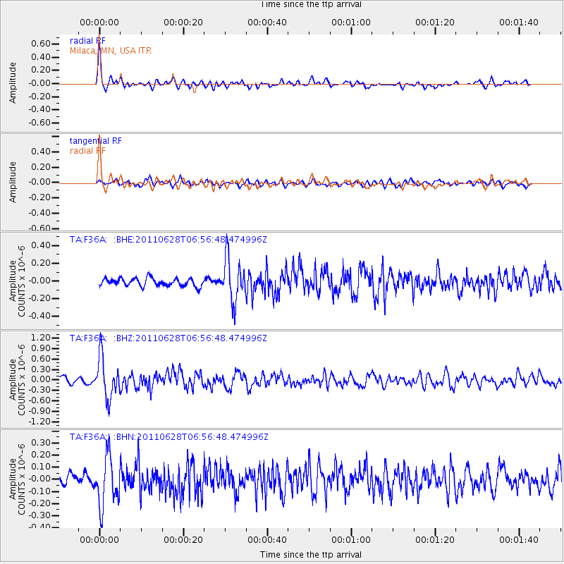
Earthquake location: Fox Islands, Aleutian Islands
Earthquake latitude/longitude: 52.1/-171.7
Earthquake time(UTC): 2011/06/28 (179) 06:48:32 GMT
Earthquake Depth: 30 km
Earthquake Magnitude: 5.6 MB, 5.4 MS, 5.9 MW, 5.6 MW
Earthquake Catalog/Contributor: WHDF/NEIC
Network: TA USArray Transportable Network (new EarthScope stations)
Station: F36A Milaca, MN, USA
Lat/Lon: 45.86 N/93.52 W
Elevation: 345 m
Distance: 49.4 deg
Az: 64.331 deg
Baz: 307.264 deg
Ray Param: 0.06869363
Estimated Moho Depth: 32.0 km
Estimated Crust Vp/Vs: 2.00
Assumed Crust Vp: 6.571 km/s
Estimated Crust Vs: 3.294 km/s
Estimated Crust Poisson's Ratio: 0.33
Radial Match: 84.46182 %
Radial Bump: 400
Transverse Match: 64.82346 %
Transverse Bump: 400
SOD ConfigId: 395004
Insert Time: 2011-12-08 06:05:17.262 +0000
GWidth: 2.5
Max Bumps: 400
Tol: 0.001

Signal To Noise

ChannelStoNSTALTA
TA:F36A: :BHZ:20110628T06:56:48.474996Z8.1751885.9654445E-77.2970124E-8
TA:F36A: :BHN:20110628T06:56:48.474996Z4.9736842.0710195E-74.163955E-8
TA:F36A: :BHE:20110628T06:56:48.474996Z5.6334882.4738355E-74.391303E-8
Arrivals
Ps5.1 SECOND
PpPs14 SECOND
PsPs/PpSs19 SECOND