E36A McGregor, MN, USA - Earthquake Result Viewer
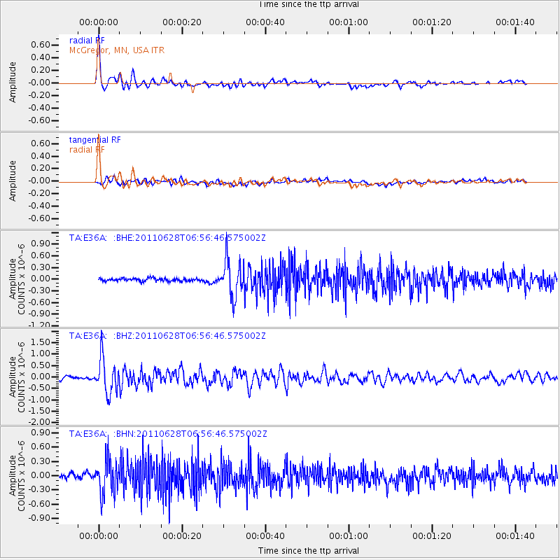
Earthquake location: Fox Islands, Aleutian Islands
Earthquake latitude/longitude: 52.1/-171.7
Earthquake time(UTC): 2011/06/28 (179) 06:48:32 GMT
Earthquake Depth: 30 km
Earthquake Magnitude: 5.6 MB, 5.4 MS, 5.9 MW, 5.6 MW
Earthquake Catalog/Contributor: WHDF/NEIC
Network: TA USArray Transportable Network (new EarthScope stations)
Station: E36A McGregor, MN, USA
Lat/Lon: 46.52 N/93.26 W
Elevation: 393 m
Distance: 49.1 deg
Az: 63.492 deg
Baz: 306.909 deg
Ray Param: 0.06885125
Estimated Moho Depth: 19.0 km
Estimated Crust Vp/Vs: 2.10
Assumed Crust Vp: 6.571 km/s
Estimated Crust Vs: 3.133 km/s
Estimated Crust Poisson's Ratio: 0.35
Radial Match: 88.00707 %
Radial Bump: 400
Transverse Match: 69.54603 %
Transverse Bump: 400
SOD ConfigId: 395004
Insert Time: 2011-12-08 06:07:05.397 +0000
GWidth: 2.5
Max Bumps: 400
Tol: 0.001

Signal To Noise

ChannelStoNSTALTA
TA:E36A: :BHZ:20110628T06:56:46.575002Z12.6212097.7962073E-76.1770685E-8
TA:E36A: :BHN:20110628T06:56:46.575002Z7.1381283.6169456E-75.067079E-8
TA:E36A: :BHE:20110628T06:56:46.575002Z13.0781434.8165145E-73.6828734E-8
Arrivals
Ps3.3 SECOND
PpPs8.5 SECOND
PsPs/PpSs12 SECOND