O38A Galt, MO, USA - Earthquake Result Viewer
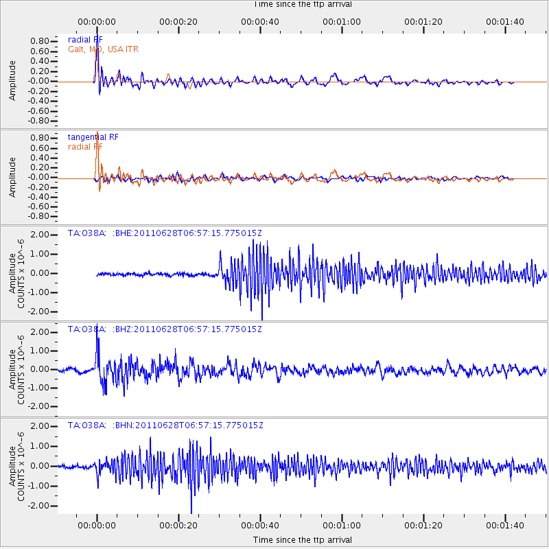
Earthquake location: Fox Islands, Aleutian Islands
Earthquake latitude/longitude: 52.1/-171.7
Earthquake time(UTC): 2011/06/28 (179) 06:48:32 GMT
Earthquake Depth: 30 km
Earthquake Magnitude: 5.6 MB, 5.4 MS, 5.9 MW, 5.6 MW
Earthquake Catalog/Contributor: WHDF/NEIC
Network: TA USArray Transportable Network (new EarthScope stations)
Station: O38A Galt, MO, USA
Lat/Lon: 40.12 N/93.47 W
Elevation: 266 m
Distance: 53.0 deg
Az: 70.018 deg
Baz: 310.867 deg
Ray Param: 0.06633098
Estimated Moho Depth: 13.0 km
Estimated Crust Vp/Vs: 1.60
Assumed Crust Vp: 6.498 km/s
Estimated Crust Vs: 4.061 km/s
Estimated Crust Poisson's Ratio: 0.18
Radial Match: 81.95087 %
Radial Bump: 400
Transverse Match: 54.753906 %
Transverse Bump: 400
SOD ConfigId: 395004
Insert Time: 2011-12-08 06:08:52.053 +0000
GWidth: 2.5
Max Bumps: 400
Tol: 0.001

Signal To Noise

ChannelStoNSTALTA
TA:O38A: :BHZ:20110628T06:57:15.775015Z11.2662027.6354075E-76.777268E-8
TA:O38A: :BHN:20110628T06:57:15.775015Z5.52035433.3652114E-76.096006E-8
TA:O38A: :BHE:20110628T06:57:15.775015Z9.7293534.984725E-75.123388E-8
Arrivals
Ps1.3 SECOND
PpPs4.9 SECOND
PsPs/PpSs6.2 SECOND