P38A Dawn, MO, USA - Earthquake Result Viewer
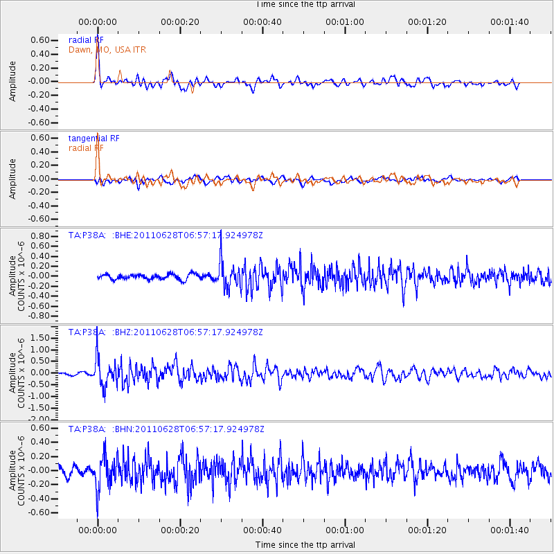
Earthquake location: Fox Islands, Aleutian Islands
Earthquake latitude/longitude: 52.1/-171.7
Earthquake time(UTC): 2011/06/28 (179) 06:48:32 GMT
Earthquake Depth: 30 km
Earthquake Magnitude: 5.6 MB, 5.4 MS, 5.9 MW, 5.6 MW
Earthquake Catalog/Contributor: WHDF/NEIC
Network: TA USArray Transportable Network (new EarthScope stations)
Station: P38A Dawn, MO, USA
Lat/Lon: 39.62 N/93.53 W
Elevation: 248 m
Distance: 53.3 deg
Az: 70.523 deg
Baz: 311.132 deg
Ray Param: 0.06613591
Estimated Moho Depth: 25.75 km
Estimated Crust Vp/Vs: 1.60
Assumed Crust Vp: 6.498 km/s
Estimated Crust Vs: 4.055 km/s
Estimated Crust Poisson's Ratio: 0.18
Radial Match: 80.8932 %
Radial Bump: 400
Transverse Match: 63.653767 %
Transverse Bump: 400
SOD ConfigId: 395004
Insert Time: 2011-12-08 06:09:05.294 +0000
GWidth: 2.5
Max Bumps: 400
Tol: 0.001

Signal To Noise

ChannelStoNSTALTA
TA:P38A: :BHZ:20110628T06:57:17.924978Z11.4801056.17819E-75.3816493E-8
TA:P38A: :BHN:20110628T06:57:17.924978Z4.44176772.3775222E-75.3526488E-8
TA:P38A: :BHE:20110628T06:57:17.924978Z5.1549392.7055518E-75.2484655E-8
Arrivals
Ps2.5 SECOND
PpPs9.7 SECOND
PsPs/PpSs12 SECOND