
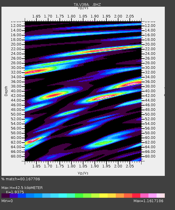
V39A Pettigrew, AR, USA - Earthquake Result Viewer
| ||||||||||||||||||
| ||||||||||||||||||
| ||||||||||||||||||
|
Signal To Noise
| Channel | StoN | STA | LTA |
| TA:V39A: :BHZ:20110628T06:57:35.825002Z | 12.937696 | 4.4792776E-7 | 3.462191E-8 |
| TA:V39A: :BHN:20110628T06:57:35.825002Z | 3.9195602 | 2.113541E-7 | 5.392291E-8 |
| TA:V39A: :BHE:20110628T06:57:35.825002Z | 3.2899685 | 1.6981933E-7 | 5.1617313E-8 |
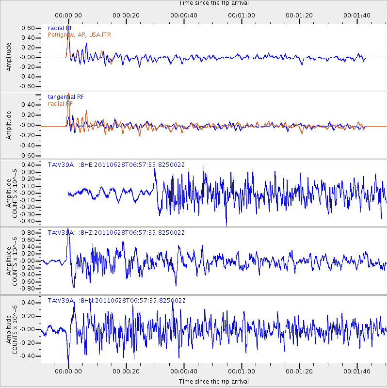
| Arrivals | |
| Ps | 6.4 SECOND |
| PpPs | 18 SECOND |
| PsPs/PpSs | 25 SECOND |

