You are here: Home > Network List > TA - USArray Transportable Network (new EarthScope stations) Stations List
> Station 242A Grayson, LA, USA > Earthquake Result Viewer
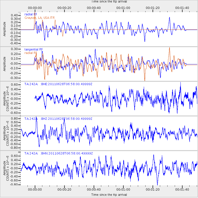
242A Grayson, LA, USA - Earthquake Result Viewer
*The percent match for this event was below the threshold and hence no stack was calculated.
| Earthquake location: |
Fox Islands, Aleutian Islands |
| Earthquake latitude/longitude: |
52.1/-171.7 |
| Earthquake time(UTC): |
2011/06/28 (179) 06:48:32 GMT |
| Earthquake Depth: |
30 km |
| Earthquake Magnitude: |
5.6 MB, 5.4 MS, 5.9 MW, 5.6 MW |
| Earthquake Catalog/Contributor: |
WHDF/NEIC |
|
| Network: |
TA USArray Transportable Network (new EarthScope stations) |
| Station: |
242A Grayson, LA, USA |
| Lat/Lon: |
32.06 N/92.15 W |
| Elevation: |
57 m |
|
| Distance: |
59.3 deg |
| Az: |
76.221 deg |
| Baz: |
315.106 deg |
| Ray Param: |
$rayparam |
*The percent match for this event was below the threshold and hence was not used in the summary stack. |
|
| Radial Match: |
68.63877 % |
| Radial Bump: |
400 |
| Transverse Match: |
55.806217 % |
| Transverse Bump: |
400 |
| SOD ConfigId: |
395004 |
| Insert Time: |
2011-12-08 06:12:04.291 +0000 |
| GWidth: |
2.5 |
| Max Bumps: |
400 |
| Tol: |
0.001 |
|
Signal To Noise
| Channel | StoN | STA | LTA |
| TA:242A: :BHZ:20110628T06:58:00.49999Z | 4.9404025 | 3.985096E-7 | 8.066339E-8 |
| TA:242A: :BHN:20110628T06:58:00.49999Z | 0.771479 | 1.3471593E-7 | 1.7462035E-7 |
| TA:242A: :BHE:20110628T06:58:00.49999Z | 1.1091617 | 1.4355781E-7 | 1.2942911E-7 |
| Arrivals |
| Ps | |
| PpPs | |
| PsPs/PpSs | |


