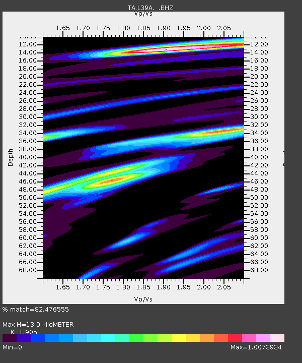
L39A Vinton, IA, USA - Earthquake Result Viewer
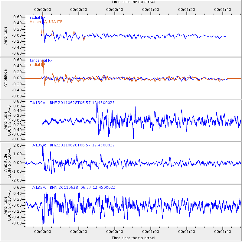
Earthquake location: Fox Islands, Aleutian Islands
Earthquake latitude/longitude: 52.1/-171.7
Earthquake time(UTC): 2011/06/28 (179) 06:48:32 GMT
Earthquake Depth: 30 km
Earthquake Magnitude: 5.6 MB, 5.4 MS, 5.9 MW, 5.6 MW
Earthquake Catalog/Contributor: WHDF/NEIC
Network: TA USArray Transportable Network (new EarthScope stations)
Station: L39A Vinton, IA, USA
Lat/Lon: 42.12 N/92.00 W
Elevation: 261 m
Distance: 52.6 deg
Az: 67.201 deg
Baz: 310.128 deg
Ray Param: 0.06662956
Estimated Moho Depth: 13.0 km
Estimated Crust Vp/Vs: 1.90
Assumed Crust Vp: 6.53 km/s
Estimated Crust Vs: 3.428 km/s
Estimated Crust Poisson's Ratio: 0.31
Radial Match: 82.476555 %
Radial Bump: 400
Transverse Match: 65.198814 %
Transverse Bump: 400
SOD ConfigId: 395004
Insert Time: 2011-12-08 06:18:00.071 +0000
GWidth: 2.5
Max Bumps: 400
Tol: 0.001

Signal To Noise

ChannelStoNSTALTA
TA:L39A: :BHZ:20110628T06:57:12.450002Z10.4283787.851687E-77.5291545E-8
TA:L39A: :BHN:20110628T06:57:12.450002Z4.9812492.936001E-75.894106E-8
TA:L39A: :BHE:20110628T06:57:12.450002Z5.08212663.3981186E-76.6864104E-8
Arrivals
Ps1.9 SECOND
PpPs5.5 SECOND
PsPs/PpSs7.4 SECOND