You are here: Home > Network List > UW - Pacific Northwest Regional Seismic Network Stations List
> Station MRBL Marblemount, WA, USA > Earthquake Result Viewer
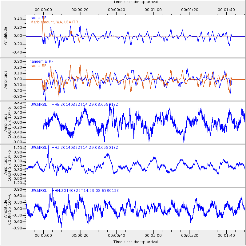
MRBL Marblemount, WA, USA - Earthquake Result Viewer
*The percent match for this event was below the threshold and hence no stack was calculated.
| Earthquake location: |
Southeast Of Honshu, Japan |
| Earthquake latitude/longitude: |
29.3/139.4 |
| Earthquake time(UTC): |
2014/03/22 (081) 14:18:47 GMT |
| Earthquake Depth: |
425 km |
| Earthquake Magnitude: |
5.4 mb |
| Earthquake Catalog/Contributor: |
ISC/ISC |
|
| Network: |
UW Pacific Northwest Regional Seismic Network |
| Station: |
MRBL Marblemount, WA, USA |
| Lat/Lon: |
48.52 N/121.48 W |
| Elevation: |
75 m |
|
| Distance: |
74.2 deg |
| Az: |
43.01 deg |
| Baz: |
296.374 deg |
| Ray Param: |
$rayparam |
*The percent match for this event was below the threshold and hence was not used in the summary stack. |
|
| Radial Match: |
61.330788 % |
| Radial Bump: |
400 |
| Transverse Match: |
45.836807 % |
| Transverse Bump: |
400 |
| SOD ConfigId: |
3390531 |
| Insert Time: |
2019-04-10 20:15:35.304 +0000 |
| GWidth: |
2.5 |
| Max Bumps: |
400 |
| Tol: |
0.001 |
|
Signal To Noise
| Channel | StoN | STA | LTA |
| UW:MRBL: :HHZ:20140322T14:29:08.658013Z | 2.6855948 | 4.702463E-7 | 1.7509949E-7 |
| UW:MRBL: :HHN:20140322T14:29:08.658013Z | 1.133987 | 3.8105827E-7 | 3.360341E-7 |
| UW:MRBL: :HHE:20140322T14:29:08.658013Z | 1.239227 | 3.4998843E-7 | 2.8242476E-7 |
| Arrivals |
| Ps | |
| PpPs | |
| PsPs/PpSs | |


