You are here: Home > Network List > TA - USArray Transportable Network (new EarthScope stations) Stations List
> Station U41A Viola, AR, USA > Earthquake Result Viewer
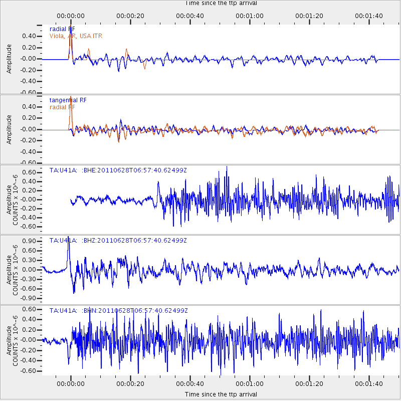
U41A Viola, AR, USA - Earthquake Result Viewer
*The percent match for this event was below the threshold and hence no stack was calculated.
| Earthquake location: |
Fox Islands, Aleutian Islands |
| Earthquake latitude/longitude: |
52.1/-171.7 |
| Earthquake time(UTC): |
2011/06/28 (179) 06:48:32 GMT |
| Earthquake Depth: |
30 km |
| Earthquake Magnitude: |
5.6 MB, 5.4 MS, 5.9 MW, 5.6 MW |
| Earthquake Catalog/Contributor: |
WHDF/NEIC |
|
| Network: |
TA USArray Transportable Network (new EarthScope stations) |
| Station: |
U41A Viola, AR, USA |
| Lat/Lon: |
36.34 N/91.92 W |
| Elevation: |
300 m |
|
| Distance: |
56.4 deg |
| Az: |
72.445 deg |
| Baz: |
313.226 deg |
| Ray Param: |
$rayparam |
*The percent match for this event was below the threshold and hence was not used in the summary stack. |
|
| Radial Match: |
75.884834 % |
| Radial Bump: |
400 |
| Transverse Match: |
66.05695 % |
| Transverse Bump: |
400 |
| SOD ConfigId: |
395004 |
| Insert Time: |
2011-12-08 06:18:40.916 +0000 |
| GWidth: |
2.5 |
| Max Bumps: |
400 |
| Tol: |
0.001 |
|
Signal To Noise
| Channel | StoN | STA | LTA |
| TA:U41A: :BHZ:20110628T06:57:40.62499Z | 6.073129 | 4.1567867E-7 | 6.844555E-8 |
| TA:U41A: :BHN:20110628T06:57:40.62499Z | 3.748674 | 2.0276113E-7 | 5.408876E-8 |
| TA:U41A: :BHE:20110628T06:57:40.62499Z | 3.916164 | 1.9397359E-7 | 4.9531533E-8 |
| Arrivals |
| Ps | |
| PpPs | |
| PsPs/PpSs | |


