You are here: Home > Network List > CI - Caltech Regional Seismic Network Stations List
> Station DEC Green Verdugo Microwave Site, Sunland, CA, USA > Earthquake Result Viewer
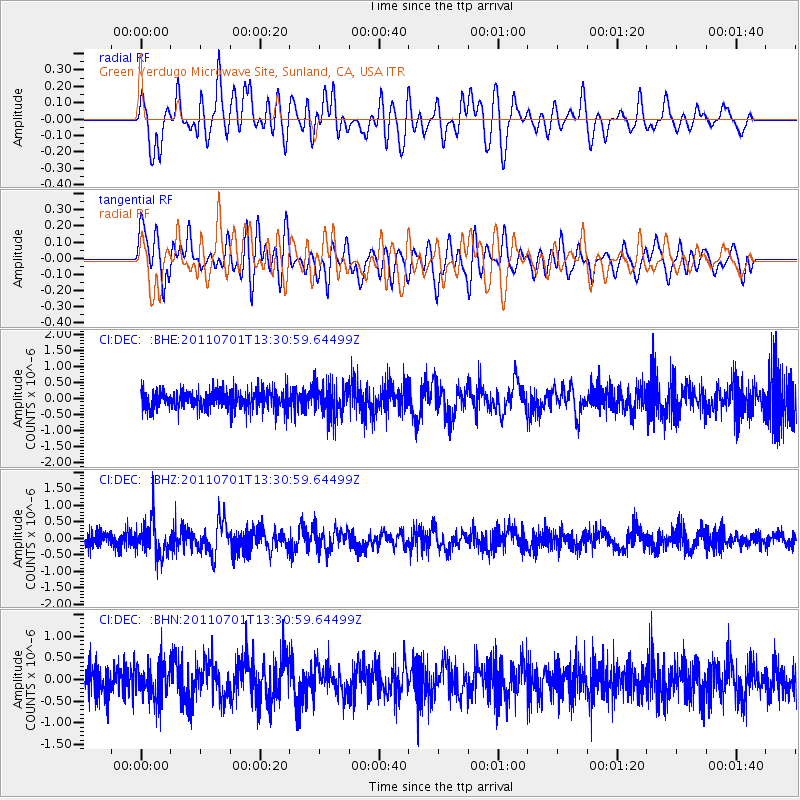
DEC Green Verdugo Microwave Site, Sunland, CA, USA - Earthquake Result Viewer
*The percent match for this event was below the threshold and hence no stack was calculated.
| Earthquake location: |
South Of Mariana Islands |
| Earthquake latitude/longitude: |
13.1/146.6 |
| Earthquake time(UTC): |
2011/07/01 (182) 13:18:50 GMT |
| Earthquake Depth: |
39 km |
| Earthquake Magnitude: |
5.9 MB, 5.2 MS, 5.6 MW, 5.5 MW |
| Earthquake Catalog/Contributor: |
WHDF/NEIC |
|
| Network: |
CI Caltech Regional Seismic Network |
| Station: |
DEC Green Verdugo Microwave Site, Sunland, CA, USA |
| Lat/Lon: |
34.25 N/118.33 W |
| Elevation: |
519 m |
|
| Distance: |
86.9 deg |
| Az: |
55.716 deg |
| Baz: |
283.633 deg |
| Ray Param: |
$rayparam |
*The percent match for this event was below the threshold and hence was not used in the summary stack. |
|
| Radial Match: |
65.744514 % |
| Radial Bump: |
400 |
| Transverse Match: |
58.589184 % |
| Transverse Bump: |
400 |
| SOD ConfigId: |
395004 |
| Insert Time: |
2011-12-08 06:43:22.847 +0000 |
| GWidth: |
2.5 |
| Max Bumps: |
400 |
| Tol: |
0.001 |
|
Signal To Noise
| Channel | StoN | STA | LTA |
| CI:DEC: :BHZ:20110701T13:30:59.64499Z | 2.7427843 | 5.31078E-7 | 1.9362733E-7 |
| CI:DEC: :BHN:20110701T13:30:59.64499Z | 1.2552342 | 3.9786931E-7 | 3.169682E-7 |
| CI:DEC: :BHE:20110701T13:30:59.64499Z | 1.6662219 | 5.015527E-7 | 3.0101194E-7 |
| Arrivals |
| Ps | |
| PpPs | |
| PsPs/PpSs | |


