You are here: Home > Network List > KN - Kyrgyz Seismic Telemetry Network Stations List
> Station TKM2 KN.TKM2 > Earthquake Result Viewer
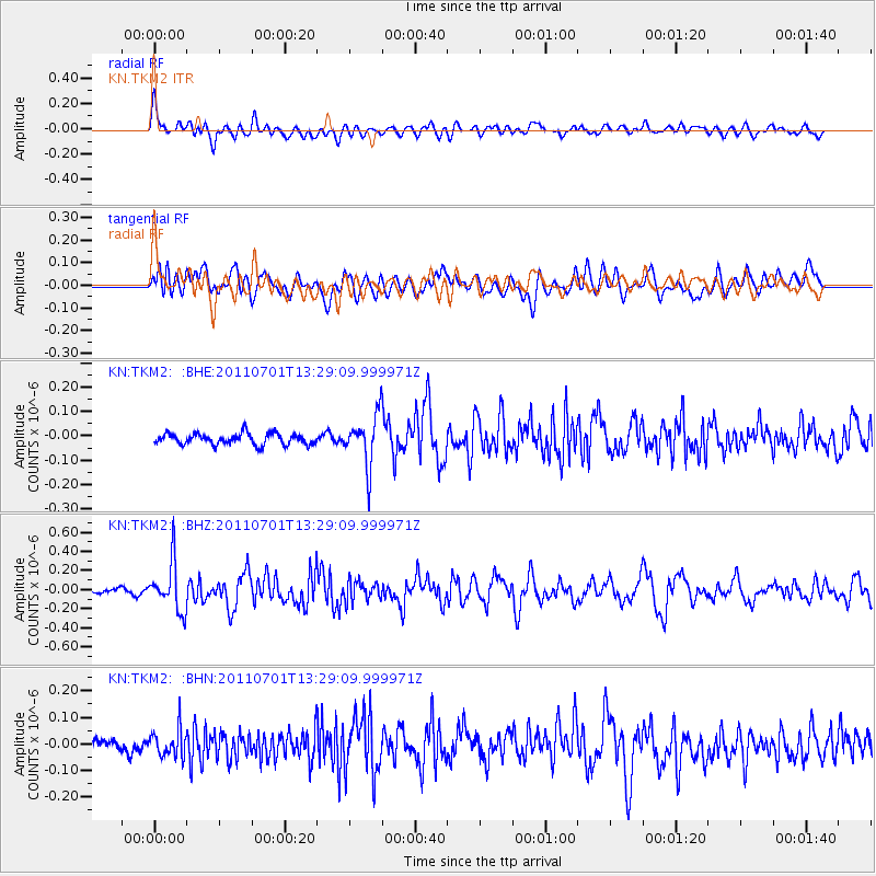
TKM2 KN.TKM2 - Earthquake Result Viewer
*The percent match for this event was below the threshold and hence no stack was calculated.
| Earthquake location: |
South Of Mariana Islands |
| Earthquake latitude/longitude: |
13.1/146.6 |
| Earthquake time(UTC): |
2011/07/01 (182) 13:18:50 GMT |
| Earthquake Depth: |
39 km |
| Earthquake Magnitude: |
5.9 MB, 5.2 MS, 5.6 MW, 5.5 MW |
| Earthquake Catalog/Contributor: |
WHDF/NEIC |
|
| Network: |
KN Kyrgyz Seismic Telemetry Network |
| Station: |
TKM2 KN.TKM2 |
| Lat/Lon: |
42.92 N/75.60 E |
| Elevation: |
2020 m |
|
| Distance: |
67.3 deg |
| Az: |
311.159 deg |
| Baz: |
93.105 deg |
| Ray Param: |
$rayparam |
*The percent match for this event was below the threshold and hence was not used in the summary stack. |
|
| Radial Match: |
68.4395 % |
| Radial Bump: |
400 |
| Transverse Match: |
62.446667 % |
| Transverse Bump: |
400 |
| SOD ConfigId: |
395004 |
| Insert Time: |
2011-12-08 06:50:11.166 +0000 |
| GWidth: |
2.5 |
| Max Bumps: |
400 |
| Tol: |
0.001 |
|
Signal To Noise
| Channel | StoN | STA | LTA |
| KN:TKM2: :BHZ:20110701T13:29:09.999971Z | 6.540165 | 2.5214197E-7 | 3.8552848E-8 |
| KN:TKM2: :BHN:20110701T13:29:09.999971Z | 1.5684501 | 4.9718448E-8 | 3.16991E-8 |
| KN:TKM2: :BHE:20110701T13:29:09.999971Z | 4.556281 | 1.037213E-7 | 2.2764462E-8 |
| Arrivals |
| Ps | |
| PpPs | |
| PsPs/PpSs | |


