You are here: Home > Network List > TA - USArray Transportable Network (new EarthScope stations) Stations List
> Station T25A Trinidad, CO, USA > Earthquake Result Viewer
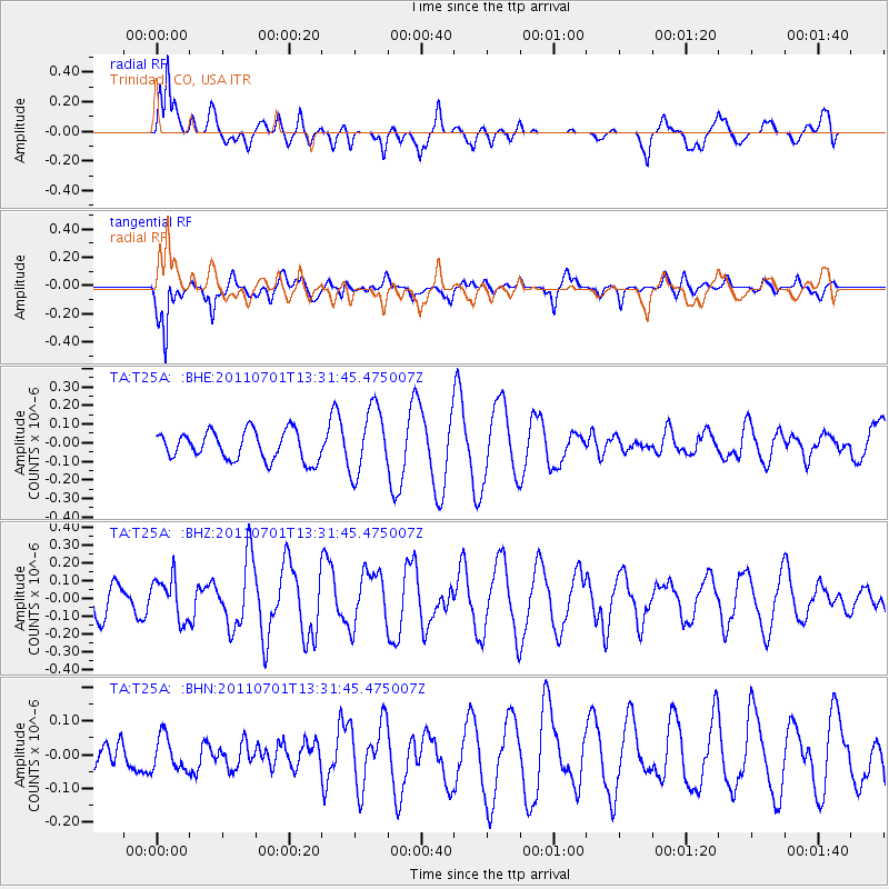
T25A Trinidad, CO, USA - Earthquake Result Viewer
*The percent match for this event was below the threshold and hence no stack was calculated.
| Earthquake location: |
South Of Mariana Islands |
| Earthquake latitude/longitude: |
13.1/146.6 |
| Earthquake time(UTC): |
2011/07/01 (182) 13:18:50 GMT |
| Earthquake Depth: |
39 km |
| Earthquake Magnitude: |
5.9 MB, 5.2 MS, 5.6 MW, 5.5 MW |
| Earthquake Catalog/Contributor: |
WHDF/NEIC |
|
| Network: |
TA USArray Transportable Network (new EarthScope stations) |
| Station: |
T25A Trinidad, CO, USA |
| Lat/Lon: |
37.14 N/104.41 W |
| Elevation: |
2017 m |
|
| Distance: |
96.8 deg |
| Az: |
49.534 deg |
| Baz: |
291.949 deg |
| Ray Param: |
$rayparam |
*The percent match for this event was below the threshold and hence was not used in the summary stack. |
|
| Radial Match: |
49.371136 % |
| Radial Bump: |
400 |
| Transverse Match: |
84.23823 % |
| Transverse Bump: |
400 |
| SOD ConfigId: |
395004 |
| Insert Time: |
2011-12-08 06:53:20.927 +0000 |
| GWidth: |
2.5 |
| Max Bumps: |
400 |
| Tol: |
0.001 |
|
Signal To Noise
| Channel | StoN | STA | LTA |
| TA:T25A: :BHZ:20110701T13:31:45.475007Z | 1.4045435 | 1.1698665E-7 | 8.3291575E-8 |
| TA:T25A: :BHN:20110701T13:31:45.475007Z | 0.5624622 | 5.195694E-8 | 9.2374094E-8 |
| TA:T25A: :BHE:20110701T13:31:45.475007Z | 2.3075018 | 1.7750318E-7 | 7.69244E-8 |
| Arrivals |
| Ps | |
| PpPs | |
| PsPs/PpSs | |


