You are here: Home > Network List > TA - USArray Transportable Network (new EarthScope stations) Stations List
> Station F32A Veblen, SD, USA > Earthquake Result Viewer
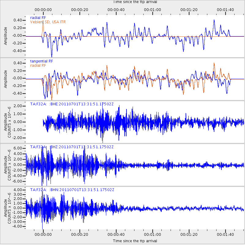
F32A Veblen, SD, USA - Earthquake Result Viewer
*The percent match for this event was below the threshold and hence no stack was calculated.
| Earthquake location: |
South Of Mariana Islands |
| Earthquake latitude/longitude: |
13.1/146.6 |
| Earthquake time(UTC): |
2011/07/01 (182) 13:18:50 GMT |
| Earthquake Depth: |
39 km |
| Earthquake Magnitude: |
5.9 MB, 5.2 MS, 5.6 MW, 5.5 MW |
| Earthquake Catalog/Contributor: |
WHDF/NEIC |
|
| Network: |
TA USArray Transportable Network (new EarthScope stations) |
| Station: |
F32A Veblen, SD, USA |
| Lat/Lon: |
45.87 N/97.13 W |
| Elevation: |
371 m |
|
| Distance: |
98.1 deg |
| Az: |
39.239 deg |
| Baz: |
298.111 deg |
| Ray Param: |
$rayparam |
*The percent match for this event was below the threshold and hence was not used in the summary stack. |
|
| Radial Match: |
52.86717 % |
| Radial Bump: |
400 |
| Transverse Match: |
47.002758 % |
| Transverse Bump: |
400 |
| SOD ConfigId: |
395004 |
| Insert Time: |
2011-12-08 06:56:25.129 +0000 |
| GWidth: |
2.5 |
| Max Bumps: |
400 |
| Tol: |
0.001 |
|
Signal To Noise
| Channel | StoN | STA | LTA |
| TA:F32A: :BHZ:20110701T13:31:51.17502Z | 2.3151088 | 3.7280886E-6 | 1.6103297E-6 |
| TA:F32A: :BHN:20110701T13:31:51.17502Z | 2.1604896 | 1.8782243E-6 | 8.6935125E-7 |
| TA:F32A: :BHE:20110701T13:31:51.17502Z | 1.6882725 | 9.62542E-7 | 5.7013426E-7 |
| Arrivals |
| Ps | |
| PpPs | |
| PsPs/PpSs | |


