CAN Canberra, Australia - Earthquake Result Viewer
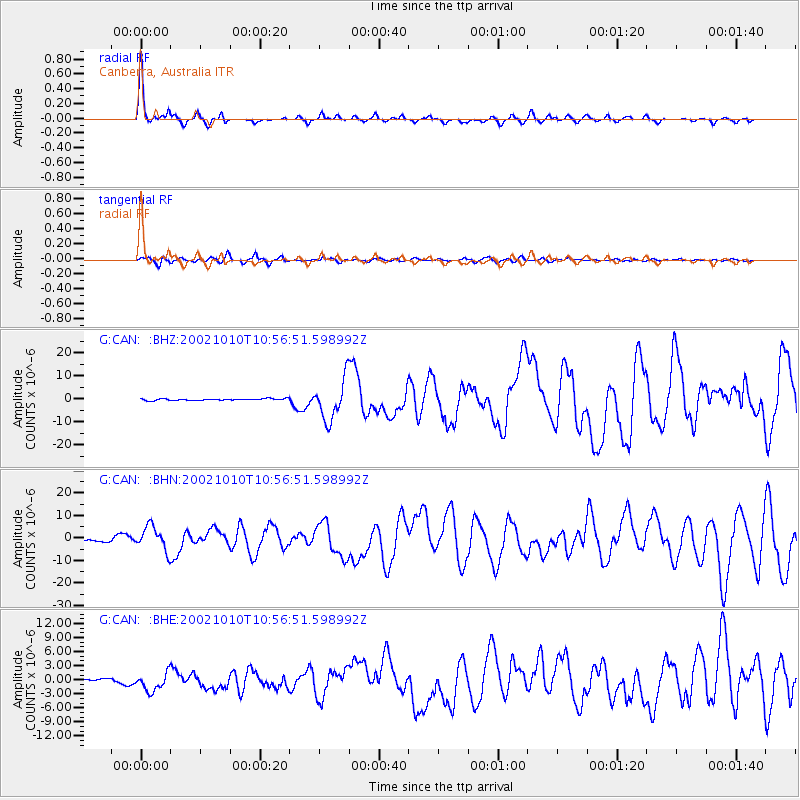
Earthquake location: Irian Jaya Region, Indonesia
Earthquake latitude/longitude: -1.8/134.3
Earthquake time(UTC): 2002/10/10 (283) 10:50:20 GMT
Earthquake Depth: 10 km
Earthquake Magnitude: 6.5 MB, 7.7 MS, 7.6 MW, 7.4 MW
Earthquake Catalog/Contributor: WHDF/NEIC
Network: G GEOSCOPE
Station: CAN Canberra, Australia
Lat/Lon: 35.32 S/149.00 E
Elevation: 650 m
Distance: 36.1 deg
Az: 159.368 deg
Baz: 334.488 deg
Ray Param: 0.07687271
Estimated Moho Depth: 31.25 km
Estimated Crust Vp/Vs: 2.10
Assumed Crust Vp: 6.633 km/s
Estimated Crust Vs: 3.162 km/s
Estimated Crust Poisson's Ratio: 0.35
Radial Match: 92.429634 %
Radial Bump: 261
Transverse Match: 80.80428 %
Transverse Bump: 400
SOD ConfigId: 4714
Insert Time: 2010-02-26 21:35:31.350 +0000
GWidth: 2.5
Max Bumps: 400
Tol: 0.001

Signal To Noise

ChannelStoNSTALTA
G:CAN: :BHN:20021010T10:56:51.598992Z12.8622135.490664E-64.268833E-7
G:CAN: :BHE:20021010T10:56:51.598992Z7.6367062.0233922E-62.6495616E-7
G:CAN: :BHZ:20021010T10:56:51.598992Z23.4618858.698517E-63.70751E-7
Arrivals
Ps5.5 SECOND
PpPs14 SECOND
PsPs/PpSs19 SECOND