You are here: Home > Network List > TA - USArray Transportable Network (new EarthScope stations) Stations List
> Station D36A Goodland, MN, USA > Earthquake Result Viewer
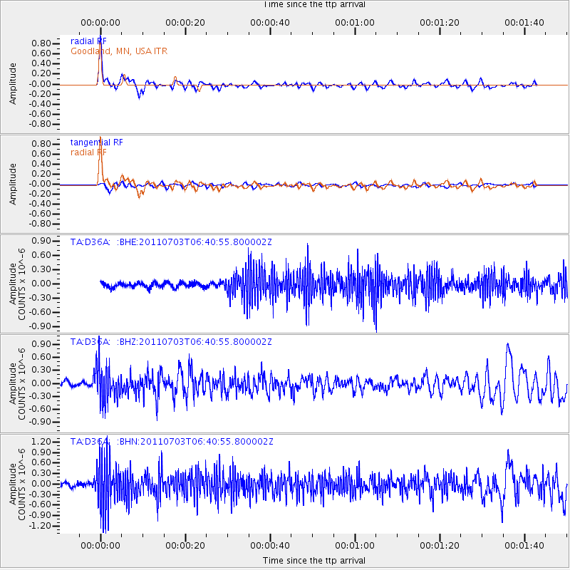
D36A Goodland, MN, USA - Earthquake Result Viewer
*The percent match for this event was below the threshold and hence no stack was calculated.
| Earthquake location: |
Near Coast Of Nicaragua |
| Earthquake latitude/longitude: |
12.4/-87.6 |
| Earthquake time(UTC): |
2011/07/03 (184) 06:34:39 GMT |
| Earthquake Depth: |
59 km |
| Earthquake Magnitude: |
5.5 MB, 5.8 MW, 5.7 MW |
| Earthquake Catalog/Contributor: |
WHDF/NEIC |
|
| Network: |
TA USArray Transportable Network (new EarthScope stations) |
| Station: |
D36A Goodland, MN, USA |
| Lat/Lon: |
47.18 N/93.16 W |
| Elevation: |
434 m |
|
| Distance: |
35.0 deg |
| Az: |
353.354 deg |
| Baz: |
170.459 deg |
| Ray Param: |
$rayparam |
*The percent match for this event was below the threshold and hence was not used in the summary stack. |
|
| Radial Match: |
78.61731 % |
| Radial Bump: |
400 |
| Transverse Match: |
62.725292 % |
| Transverse Bump: |
400 |
| SOD ConfigId: |
395004 |
| Insert Time: |
2011-12-10 05:02:01.857 +0000 |
| GWidth: |
2.5 |
| Max Bumps: |
400 |
| Tol: |
0.001 |
|
Signal To Noise
| Channel | StoN | STA | LTA |
| TA:D36A: :BHZ:20110703T06:40:55.800002Z | 7.6476054 | 4.013939E-7 | 5.248622E-8 |
| TA:D36A: :BHN:20110703T06:40:55.800002Z | 9.079576 | 6.749114E-7 | 7.4332924E-8 |
| TA:D36A: :BHE:20110703T06:40:55.800002Z | 5.033515 | 2.5925758E-7 | 5.1506273E-8 |
| Arrivals |
| Ps | |
| PpPs | |
| PsPs/PpSs | |


