CAN Canberra, Australia - Earthquake Result Viewer
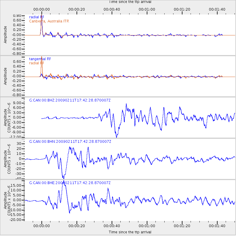
Earthquake location: Talaud Islands, Indonesia
Earthquake latitude/longitude: 3.9/126.4
Earthquake time(UTC): 2009/02/11 (042) 17:34:50 GMT
Earthquake Depth: 22 km
Earthquake Magnitude: 6.6 MB, 7.2 MS, 7.2 MW, 7.1 MW
Earthquake Catalog/Contributor: WHDF/NEIC
Network: G GEOSCOPE
Station: CAN Canberra, Australia
Lat/Lon: 35.32 S/149.00 E
Elevation: 650 m
Distance: 44.4 deg
Az: 153.307 deg
Baz: 326.764 deg
Ray Param: 0.071910255
Estimated Moho Depth: 34.5 km
Estimated Crust Vp/Vs: 1.92
Assumed Crust Vp: 6.633 km/s
Estimated Crust Vs: 3.446 km/s
Estimated Crust Poisson's Ratio: 0.32
Radial Match: 96.89794 %
Radial Bump: 314
Transverse Match: 86.8325 %
Transverse Bump: 400
SOD ConfigId: 2658
Insert Time: 2010-02-26 21:35:42.224 +0000
GWidth: 2.5
Max Bumps: 400
Tol: 0.001

Signal To Noise

ChannelStoNSTALTA
G:CAN:00:BHN:20090211T17:42:28.870007Z9.4244423.7178982E-63.9449532E-7
G:CAN:00:BHE:20090211T17:42:28.870007Z5.57077261.8787524E-63.372517E-7
G:CAN:00:BHZ:20090211T17:42:28.870007Z3.32474689.567938E-72.8777944E-7
Arrivals
Ps5.1 SECOND
PpPs14 SECOND
PsPs/PpSs19 SECOND