MPP McPhearson Peak - Earthquake Result Viewer
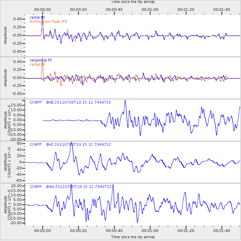
Earthquake location: Kermadec Islands Region
Earthquake latitude/longitude: -29.5/-176.3
Earthquake time(UTC): 2011/07/06 (187) 19:03:18 GMT
Earthquake Depth: 17 km
Earthquake Magnitude: 7.0 MB, 7.8 MS, 7.6 MW, 7.6 MW
Earthquake Catalog/Contributor: WHDF/NEIC
Network: CI Caltech Regional Seismic Network
Station: MPP McPhearson Peak
Lat/Lon: 34.89 N/119.81 W
Elevation: 1739 m
Distance: 83.3 deg
Az: 43.659 deg
Baz: 227.039 deg
Ray Param: 0.04623937
Estimated Moho Depth: 25.25 km
Estimated Crust Vp/Vs: 2.06
Assumed Crust Vp: 6.1 km/s
Estimated Crust Vs: 2.965 km/s
Estimated Crust Poisson's Ratio: 0.35
Radial Match: 91.07603 %
Radial Bump: 400
Transverse Match: 86.43264 %
Transverse Bump: 400
SOD ConfigId: 395004
Insert Time: 2011-12-10 05:25:47.593 +0000
GWidth: 2.5
Max Bumps: 400
Tol: 0.001

Signal To Noise

ChannelStoNSTALTA
CI:MPP: :BHZ:20110706T19:15:12.794973Z50.536728.617408E-61.7051775E-7
CI:MPP: :BHN:20110706T19:15:12.794973Z7.4936192.583731E-63.4479083E-7
CI:MPP: :BHE:20110706T19:15:12.794973Z6.84880072.1572846E-63.149872E-7
Arrivals
Ps4.5 SECOND
PpPs12 SECOND
PsPs/PpSs17 SECOND