MUR Murrieta - Earthquake Result Viewer
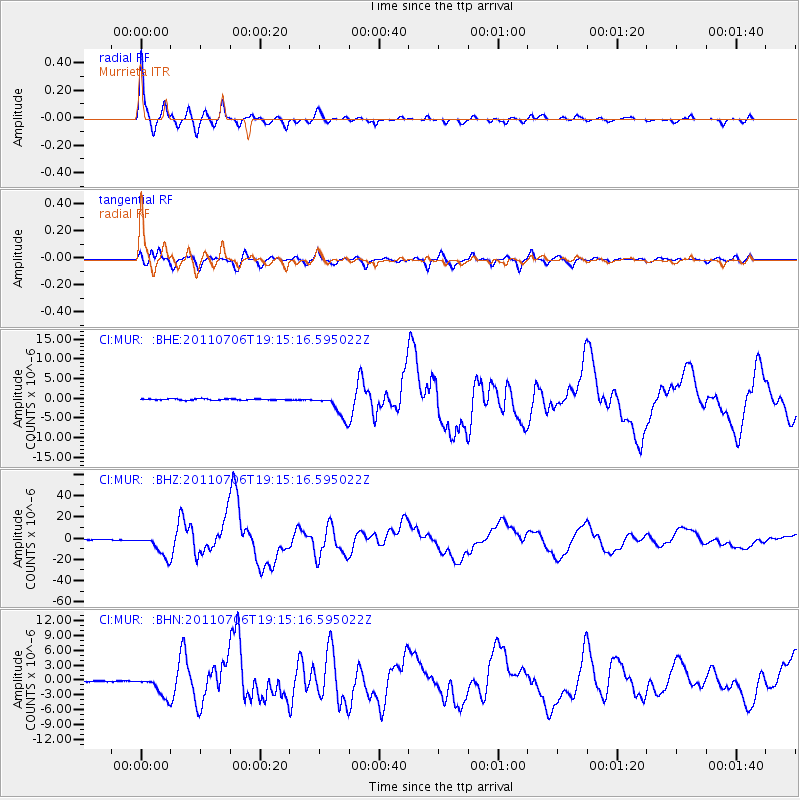
Earthquake location: Kermadec Islands Region
Earthquake latitude/longitude: -29.5/-176.3
Earthquake time(UTC): 2011/07/06 (187) 19:03:18 GMT
Earthquake Depth: 17 km
Earthquake Magnitude: 7.0 MB, 7.8 MS, 7.6 MW, 7.6 MW
Earthquake Catalog/Contributor: WHDF/NEIC
Network: CI Caltech Regional Seismic Network
Station: MUR Murrieta
Lat/Lon: 33.60 N/117.20 W
Elevation: 562 m
Distance: 84.1 deg
Az: 46.081 deg
Baz: 228.771 deg
Ray Param: 0.045709476
Estimated Moho Depth: 61.75 km
Estimated Crust Vp/Vs: 2.08
Assumed Crust Vp: 6.264 km/s
Estimated Crust Vs: 3.011 km/s
Estimated Crust Poisson's Ratio: 0.35
Radial Match: 96.77366 %
Radial Bump: 328
Transverse Match: 92.18168 %
Transverse Bump: 400
SOD ConfigId: 395004
Insert Time: 2011-12-10 05:26:57.861 +0000
GWidth: 2.5
Max Bumps: 400
Tol: 0.001

Signal To Noise

ChannelStoNSTALTA
CI:MUR: :BHZ:20110706T19:15:16.595022Z103.8184051.0550587E-51.016254E-7
CI:MUR: :BHN:20110706T19:15:16.595022Z13.4319232.2290449E-61.6595129E-7
CI:MUR: :BHE:20110706T19:15:16.595022Z19.6563133.0697809E-61.5617276E-7
Arrivals
Ps11 SECOND
PpPs30 SECOND
PsPs/PpSs41 SECOND