
CAN Canberra, Australia - Earthquake Result Viewer
| ||||||||||||||||||
| ||||||||||||||||||
| ||||||||||||||||||
|
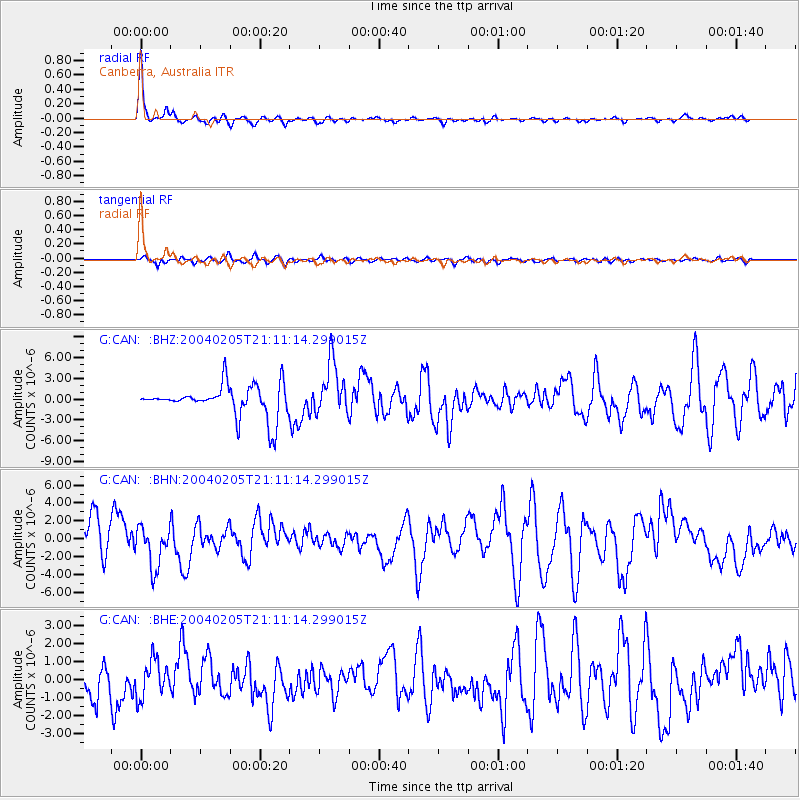
Signal To Noise
| Channel | StoN | STA | LTA |
| G:CAN: :BHN:20040205T21:11:14.299015Z | 1.6808941 | 2.3012988E-6 | 1.369092E-6 |
| G:CAN: :BHE:20040205T21:11:14.299015Z | 1.9770378 | 1.0194816E-6 | 5.1566116E-7 |
| G:CAN: :BHZ:20040205T21:11:14.299015Z | 1.6948681 | 3.8002233E-6 | 2.2421941E-6 |
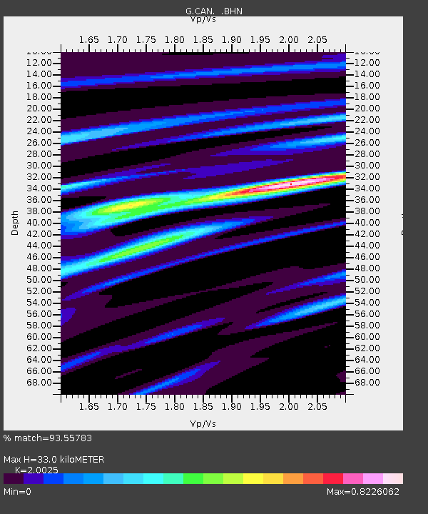
| Arrivals | |
| Ps | 5.4 SECOND |
| PpPs | 14 SECOND |
| PsPs/PpSs | 19 SECOND |

