LTY Liberty (broad-band) - Earthquake Result Viewer
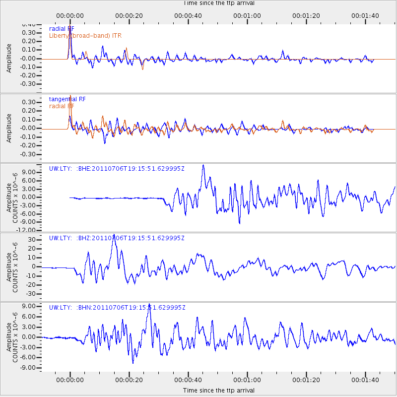
Earthquake location: Kermadec Islands Region
Earthquake latitude/longitude: -29.5/-176.3
Earthquake time(UTC): 2011/07/06 (187) 19:03:18 GMT
Earthquake Depth: 17 km
Earthquake Magnitude: 7.0 MB, 7.8 MS, 7.6 MW, 7.6 MW
Earthquake Catalog/Contributor: WHDF/NEIC
Network: UW Pacific Northwest Regional Seismic Network
Station: LTY Liberty (broad-band)
Lat/Lon: 47.26 N/120.66 W
Elevation: 970 m
Distance: 91.4 deg
Az: 34.244 deg
Baz: 226.046 deg
Ray Param: 0.041603826
Estimated Moho Depth: 24.0 km
Estimated Crust Vp/Vs: 2.10
Assumed Crust Vp: 6.597 km/s
Estimated Crust Vs: 3.145 km/s
Estimated Crust Poisson's Ratio: 0.35
Radial Match: 93.05351 %
Radial Bump: 400
Transverse Match: 90.94904 %
Transverse Bump: 400
SOD ConfigId: 395004
Insert Time: 2011-12-10 05:42:25.280 +0000
GWidth: 2.5
Max Bumps: 400
Tol: 0.001

Signal To Noise

ChannelStoNSTALTA
UW:LTY: :BHZ:20110706T19:15:51.629995Z63.8235557.1255836E-61.1164504E-7
UW:LTY: :BHN:20110706T19:15:51.629995Z7.2991897.844974E-71.07477334E-7
UW:LTY: :BHE:20110706T19:15:51.629995Z20.4086782.1281312E-61.042758E-7
Arrivals
Ps4.1 SECOND
PpPs11 SECOND
PsPs/PpSs15 SECOND