You are here: Home > Network List > CI - Caltech Regional Seismic Network Stations List
> Station MPM Manuel Prospect Mine, California, USA > Earthquake Result Viewer
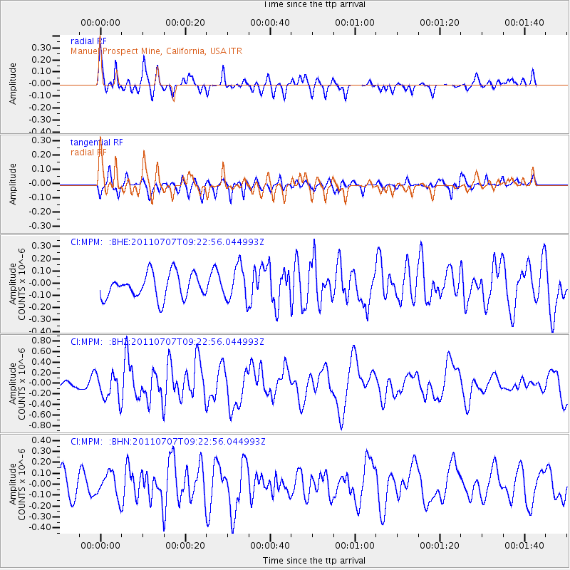
MPM Manuel Prospect Mine, California, USA - Earthquake Result Viewer
*The percent match for this event was below the threshold and hence no stack was calculated.
| Earthquake location: |
Kermadec Islands Region |
| Earthquake latitude/longitude: |
-29.0/-176.7 |
| Earthquake time(UTC): |
2011/07/07 (188) 09:10:50 GMT |
| Earthquake Depth: |
10 km |
| Earthquake Magnitude: |
5.6 MB, 5.6 MS, 5.7 MW |
| Earthquake Catalog/Contributor: |
WHDF/NEIC |
|
| Network: |
CI Caltech Regional Seismic Network |
| Station: |
MPM Manuel Prospect Mine, California, USA |
| Lat/Lon: |
36.06 N/117.49 W |
| Elevation: |
185 m |
|
| Distance: |
85.4 deg |
| Az: |
44.303 deg |
| Baz: |
229.047 deg |
| Ray Param: |
$rayparam |
*The percent match for this event was below the threshold and hence was not used in the summary stack. |
|
| Radial Match: |
71.02048 % |
| Radial Bump: |
400 |
| Transverse Match: |
61.560184 % |
| Transverse Bump: |
381 |
| SOD ConfigId: |
395004 |
| Insert Time: |
2011-12-10 05:53:10.456 +0000 |
| GWidth: |
2.5 |
| Max Bumps: |
400 |
| Tol: |
0.001 |
|
Signal To Noise
| Channel | StoN | STA | LTA |
| CI:MPM: :BHZ:20110707T09:22:56.044993Z | 3.054944 | 2.4210098E-7 | 7.924891E-8 |
| CI:MPM: :BHN:20110707T09:22:56.044993Z | 1.4665112 | 1.15390215E-7 | 7.868348E-8 |
| CI:MPM: :BHE:20110707T09:22:56.044993Z | 1.4352821 | 1.4288601E-7 | 9.9552565E-8 |
| Arrivals |
| Ps | |
| PpPs | |
| PsPs/PpSs | |


