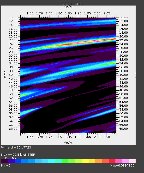
CAN Canberra, Australia - Earthquake Result Viewer
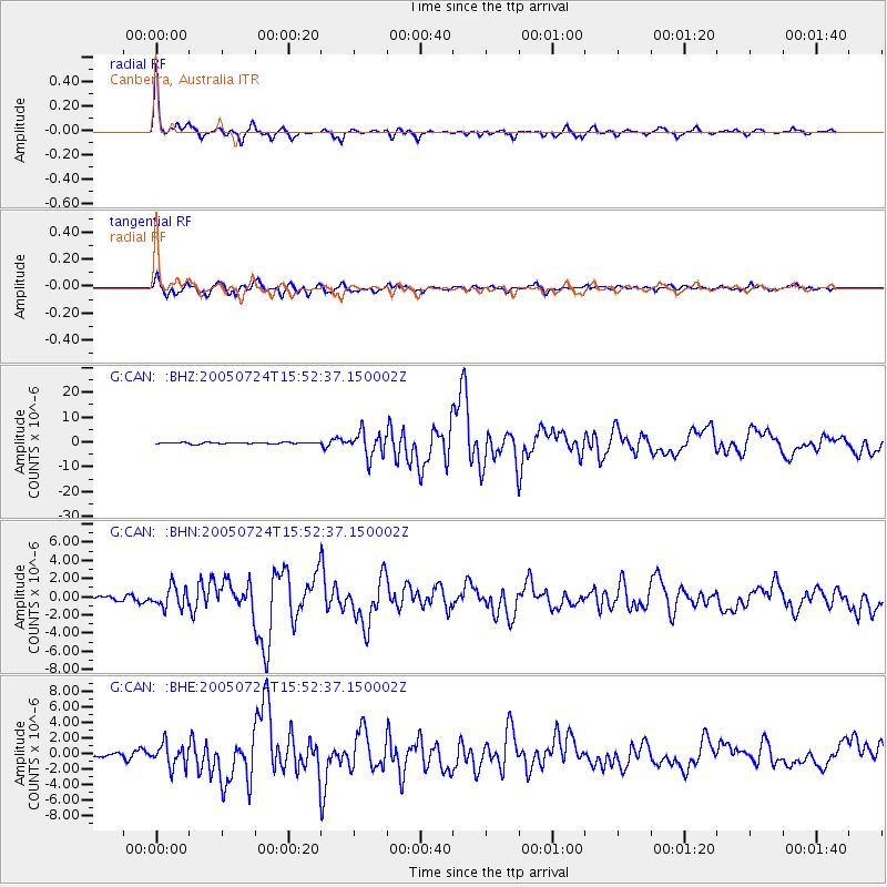
Earthquake location: Nicobar Islands, India Region
Earthquake latitude/longitude: 7.9/92.2
Earthquake time(UTC): 2005/07/24 (205) 15:42:06 GMT
Earthquake Depth: 16 km
Earthquake Magnitude: 6.6 MB, 7.5 MS, 7.3 MW, 7.2 MW
Earthquake Catalog/Contributor: WHDF/NEIC
Network: G GEOSCOPE
Station: CAN Canberra, Australia
Lat/Lon: 35.32 S/149.00 E
Elevation: 650 m
Distance: 68.6 deg
Az: 132.698 deg
Baz: 297.092 deg
Ray Param: 0.056176987
Estimated Moho Depth: 22.5 km
Estimated Crust Vp/Vs: 1.95
Assumed Crust Vp: 6.633 km/s
Estimated Crust Vs: 3.402 km/s
Estimated Crust Poisson's Ratio: 0.32
Radial Match: 96.17723 %
Radial Bump: 329
Transverse Match: 89.522736 %
Transverse Bump: 400
SOD ConfigId: 2564
Insert Time: 2010-02-26 21:36:30.121 +0000
GWidth: 2.5
Max Bumps: 400
Tol: 0.001

Signal To Noise

ChannelStoNSTALTA
G:CAN: :BHN:20050724T15:52:37.150002Z4.53083321.1563224E-62.5521183E-7
G:CAN: :BHE:20050724T15:52:37.150002Z4.1583781.4616082E-63.514852E-7
G:CAN: :BHZ:20050724T15:52:37.150002Z17.2204934.898609E-62.844639E-7
Arrivals
Ps3.3 SECOND
PpPs9.6 SECOND
PsPs/PpSs13 SECOND