You are here: Home > Network List > CI - Caltech Regional Seismic Network Stations List
> Station BEL Belle Mtn, Joshua Tree National Park, CA, USA > Earthquake Result Viewer
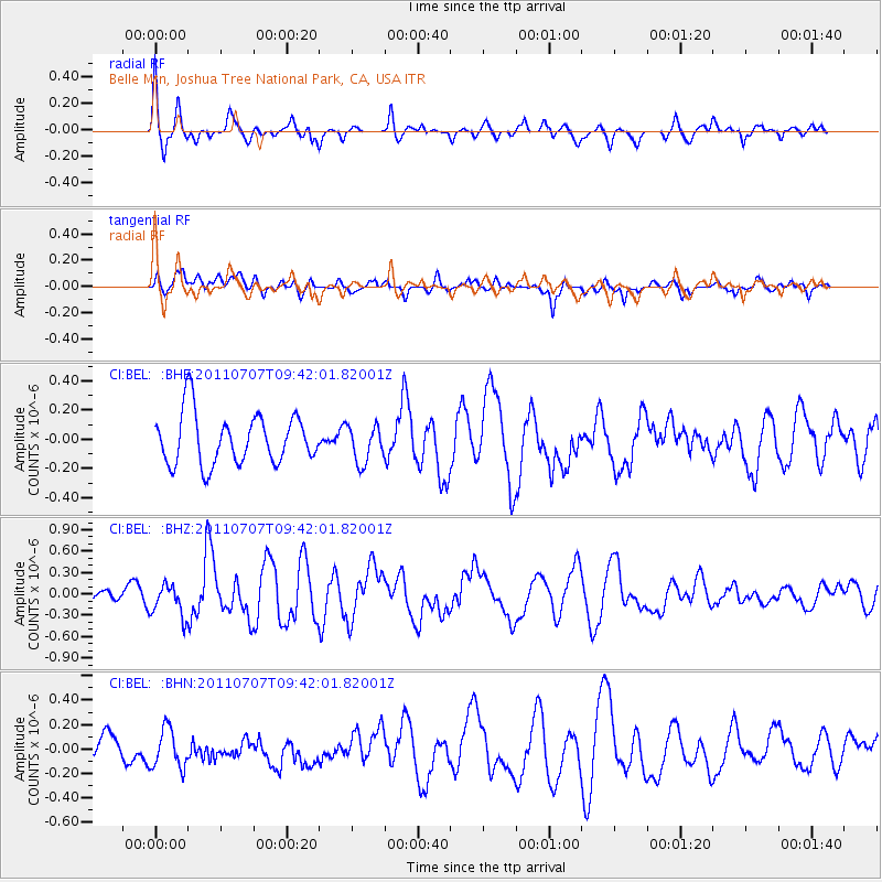
BEL Belle Mtn, Joshua Tree National Park, CA, USA - Earthquake Result Viewer
*The percent match for this event was below the threshold and hence no stack was calculated.
| Earthquake location: |
Kermadec Islands Region |
| Earthquake latitude/longitude: |
-29.2/-176.9 |
| Earthquake time(UTC): |
2011/07/07 (188) 09:29:59 GMT |
| Earthquake Depth: |
31 km |
| Earthquake Magnitude: |
5.7 MS, 5.4 MB, 5.8 MW |
| Earthquake Catalog/Contributor: |
WHDF/NEIC |
|
| Network: |
CI Caltech Regional Seismic Network |
| Station: |
BEL Belle Mtn, Joshua Tree National Park, CA, USA |
| Lat/Lon: |
34.00 N/116.00 W |
| Elevation: |
1388 m |
|
| Distance: |
85.2 deg |
| Az: |
46.78 deg |
| Baz: |
230.11 deg |
| Ray Param: |
$rayparam |
*The percent match for this event was below the threshold and hence was not used in the summary stack. |
|
| Radial Match: |
70.29115 % |
| Radial Bump: |
400 |
| Transverse Match: |
43.72718 % |
| Transverse Bump: |
400 |
| SOD ConfigId: |
395004 |
| Insert Time: |
2011-12-10 06:09:36.068 +0000 |
| GWidth: |
2.5 |
| Max Bumps: |
400 |
| Tol: |
0.001 |
|
Signal To Noise
| Channel | StoN | STA | LTA |
| CI:BEL: :BHZ:20110707T09:42:01.82001Z | 2.1304727 | 2.2819671E-7 | 1.0711084E-7 |
| CI:BEL: :BHN:20110707T09:42:01.82001Z | 1.4958324 | 1.5909889E-7 | 1.0636143E-7 |
| CI:BEL: :BHE:20110707T09:42:01.82001Z | 0.7379714 | 1.265892E-7 | 1.7153674E-7 |
| Arrivals |
| Ps | |
| PpPs | |
| PsPs/PpSs | |


