You are here: Home > Network List > IU - Global Seismograph Network (GSN - IRIS/USGS) Stations List
> Station SLBS Sierra la Laguna Baja California Sur, Mexico > Earthquake Result Viewer
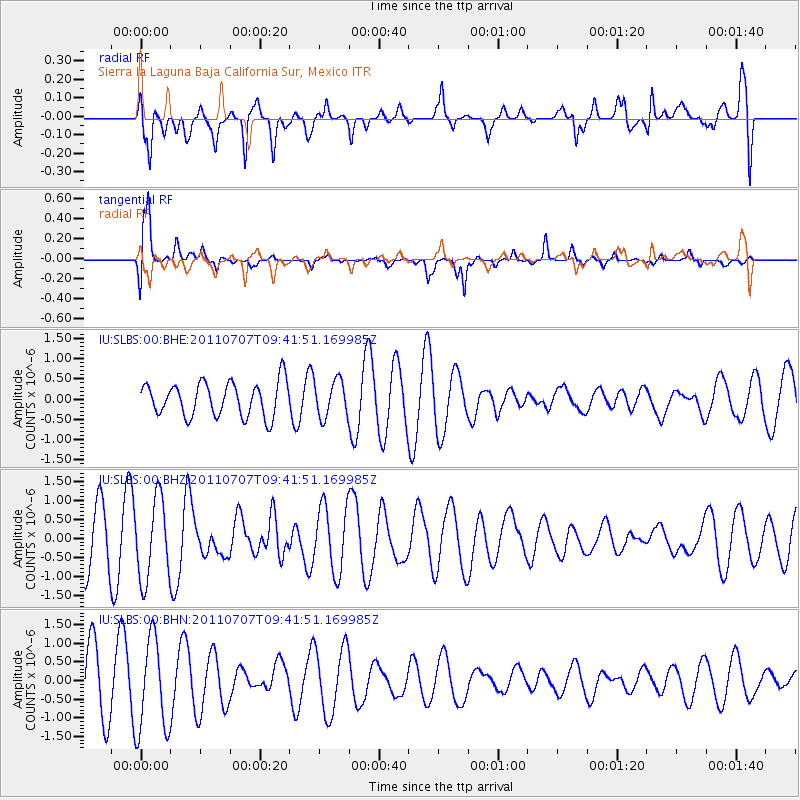
SLBS Sierra la Laguna Baja California Sur, Mexico - Earthquake Result Viewer
*The percent match for this event was below the threshold and hence no stack was calculated.
| Earthquake location: |
Kermadec Islands Region |
| Earthquake latitude/longitude: |
-29.2/-176.9 |
| Earthquake time(UTC): |
2011/07/07 (188) 09:29:59 GMT |
| Earthquake Depth: |
31 km |
| Earthquake Magnitude: |
5.7 MS, 5.4 MB, 5.8 MW |
| Earthquake Catalog/Contributor: |
WHDF/NEIC |
|
| Network: |
IU Global Seismograph Network (GSN - IRIS/USGS) |
| Station: |
SLBS Sierra la Laguna Baja California Sur, Mexico |
| Lat/Lon: |
23.69 N/109.94 W |
| Elevation: |
825 m |
|
| Distance: |
83.1 deg |
| Az: |
58.209 deg |
| Baz: |
234.193 deg |
| Ray Param: |
$rayparam |
*The percent match for this event was below the threshold and hence was not used in the summary stack. |
|
| Radial Match: |
67.411766 % |
| Radial Bump: |
400 |
| Transverse Match: |
79.3462 % |
| Transverse Bump: |
400 |
| SOD ConfigId: |
395004 |
| Insert Time: |
2011-12-10 06:10:26.203 +0000 |
| GWidth: |
2.5 |
| Max Bumps: |
400 |
| Tol: |
0.001 |
|
Signal To Noise
| Channel | StoN | STA | LTA |
| IU:SLBS:00:BHZ:20110707T09:41:51.169985Z | 1.5035046 | 1.0725041E-6 | 7.13336E-7 |
| IU:SLBS:00:BHN:20110707T09:41:51.169985Z | 1.6514431 | 1.2493404E-6 | 7.5651434E-7 |
| IU:SLBS:00:BHE:20110707T09:41:51.169985Z | 1.0900761 | 4.5536214E-7 | 4.177343E-7 |
| Arrivals |
| Ps | |
| PpPs | |
| PsPs/PpSs | |


