You are here: Home > Network List > KN - Kyrgyz Seismic Telemetry Network Stations List
> Station CHM KN.CHM > Earthquake Result Viewer
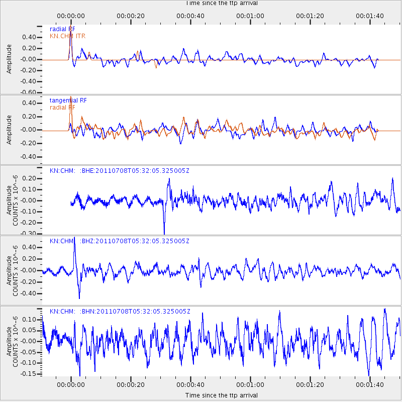
CHM KN.CHM - Earthquake Result Viewer
*The percent match for this event was below the threshold and hence no stack was calculated.
| Earthquake location: |
Minahassa Peninsula, Sulawesi |
| Earthquake latitude/longitude: |
0.1/123.2 |
| Earthquake time(UTC): |
2011/07/08 (189) 05:22:40 GMT |
| Earthquake Depth: |
159 km |
| Earthquake Magnitude: |
5.6 MB, 5.4 MW, 5.3 MW |
| Earthquake Catalog/Contributor: |
WHDF/NEIC |
|
| Network: |
KN Kyrgyz Seismic Telemetry Network |
| Station: |
CHM KN.CHM |
| Lat/Lon: |
43.00 N/74.75 E |
| Elevation: |
655 m |
|
| Distance: |
60.8 deg |
| Az: |
320.998 deg |
| Baz: |
120.927 deg |
| Ray Param: |
$rayparam |
*The percent match for this event was below the threshold and hence was not used in the summary stack. |
|
| Radial Match: |
70.80402 % |
| Radial Bump: |
400 |
| Transverse Match: |
61.44031 % |
| Transverse Bump: |
400 |
| SOD ConfigId: |
395004 |
| Insert Time: |
2011-12-10 06:20:46.944 +0000 |
| GWidth: |
2.5 |
| Max Bumps: |
400 |
| Tol: |
0.001 |
|
Signal To Noise
| Channel | StoN | STA | LTA |
| KN:CHM: :BHZ:20110708T05:32:05.325005Z | 4.04326 | 2.013132E-7 | 4.9789822E-8 |
| KN:CHM: :BHN:20110708T05:32:05.325005Z | 1.2227823 | 5.741965E-8 | 4.6958196E-8 |
| KN:CHM: :BHE:20110708T05:32:05.325005Z | 3.4188614 | 1.01451135E-7 | 2.9673954E-8 |
| Arrivals |
| Ps | |
| PpPs | |
| PsPs/PpSs | |


